Escaped Scrap Scrapes Steep Scarp
Note: At the bottom of this post is a gallery of more jaw-dropping pictures of volcanoes taken from space.
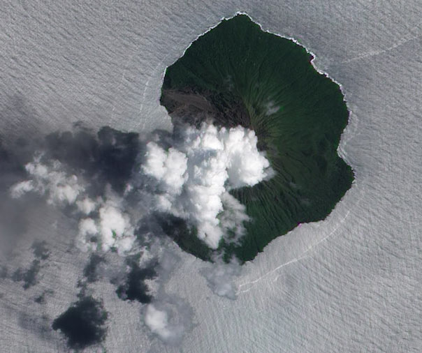
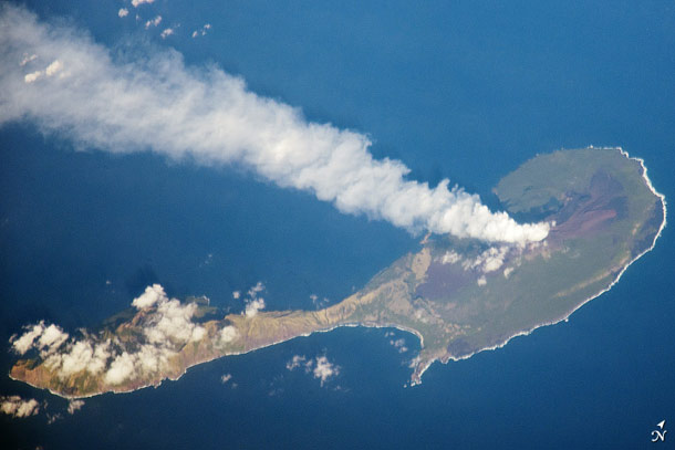
I'll admit it: sometimes I write posts just for the titles. But in this case I do have a very cool picture to go along with it: the volcano Batu Tara on the wee island of Pulau Komba in Indonesia, caught in a low-level eruption by NASA's Earth Observing-1 satellite on August 15, 2012:

[Click to hephaestenate.]
How awesome is that? The island really is tiny, just about 3 kilometers (about 1.5 miles) across. The volcano has had mild activity going on now for about six years. The ash plume is right smack dab in the middle, rising straight up toward the sky - note the shadow on the lower left.
But what amazed me right away was the tremendous scar in the island left by previous eruptions. The summit of the volcano is about 800 meters above sea level - about half a mile! Since the island is so small, that means the slope of that runoff is really steep, probably around 45°. Technically, such a geologic feature is called a "scarp"... and now my title hopefully makes sense.
I love these images of volcanoes seen from space. We get a perspective on them that's new, and amazing, and simply beautiful. And we learn so much! In another life, perhaps, I would've been a geologist. And hey, since the Earth's a part of the Universe, it all boils down to astronomy anyway.
Bad Astronomy Gallery
(click any image to see it full size)
Original image
Blog Post
Credit: NASA
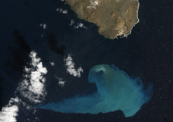
But it's the water that makes this image so odd and lovely. It's actually natural color; the sunlight is glinting off the water, giving it that silver sheen.
Original image
Blog post
Image credit: NASA/Jesse Allen and Robert Simmon (Earth Observatory)
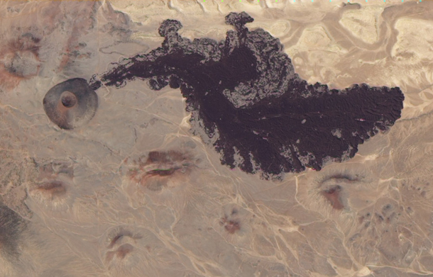
Holy wow! I had no idea that area was volcanic, but it turns out it's a rift zone, where tow continental plates are separating. Earthquakes are relatively common, and then of course entirely new volcanoes sometimes pop up, too.
Now there's a way to part the Red Sea.
Original Image
Blog post
Image credit: NASA Earth Observatory/Jesse Allen, using EO-1 ALI data provided courtesy of the NASA EO-1 team.
Original image
Blog post
Image credit: NASA/Jesse Allen and Robert Simmon using EO-1 ALI data
Original image
Blog post
Image credit: NASA Earth Observatory/Jesse Allen and Robert Simmon, using EO-1 ALI data
I love pictures of volcanoes from space, but this one is among my very favorites.
Original image
Blog post
Image credit: NASA/Jesse Allen and Robert Simmon, using EO- ALI data provided courtesy of the NASA EO-1 team
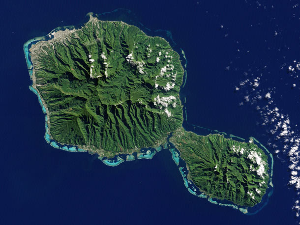
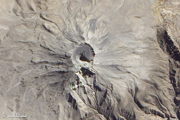
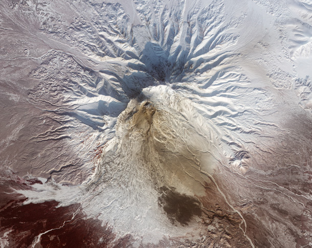
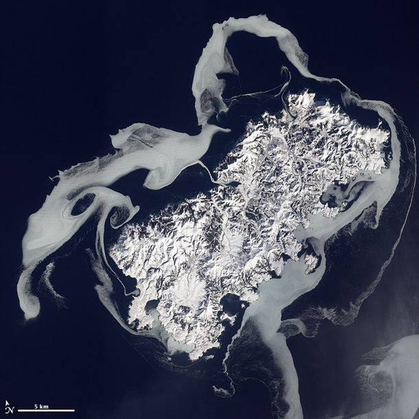
Both shield volcanoes have collapsed, and heavy erosion from rainfall has radically changed their appearance from all that time ago when they formed. This Landsat 7 image makes all that very clear... though I imagine from ground level it's far, far tougher to see.
Original image
Credit: NASA Earth Observatory image by Jesse Allen and Robert Simmon, using Landsat data from the U.S. Geological Survey.
Original image
Blog post
Image credit: NASA
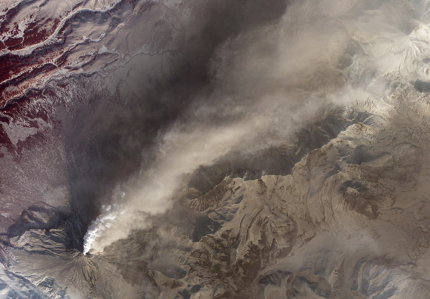
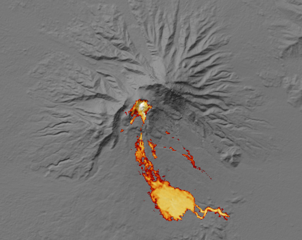
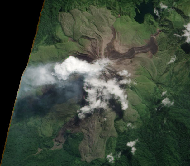
The plume is white and tan, meaning it has water vapor in it as well as ash, and fresh ash falls line the flanks. These may also be from pyroclastic flows - torrential waves of burning hot ash which plow down the slopes at hundreds of kilometers per hour.
Original image
NASA Earth Observatory image by Robert Simmon, using data from the NASA/GSFC/METI/ERSDAC/JAROS, and U.S./Japan ASTER Science Team.