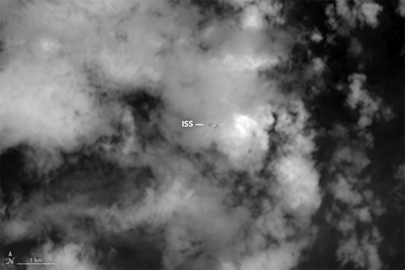
Looking Down on the International Space Station. Literally.
Well, here’s something you don’t see every day … because you can’t see it every day. Or even any day. It’s the International Space Station moving across the cloudy Earth, as seen from above.
That animation was created using images taken on June 19 by the Operational Land Imager on Landsat 8, an Earth-observing satellite, as they both passed over India. ISS orbits about 400 kilometers above the Earth, but Landsat 8 is 300 kilometers higher, so it looks “down” on the station. The orbits are tilted differently, too: The orbit of ISS is tipped by about 51° to the Earth’s equator while Landsat 8 is tipped 98° (it passes very close to directly over the poles, but because the orbital tilt is more than 90°, it technically moves backward relative to Earth, called a retrograde orbit).
Because of their different altitudes and tilts, the two objects move pretty quickly relative to each other, zipping by at several kilometers per second. And that’s where this gets interesting.
Did you notice the clouds look different in each frame of the animation? That’s because the OLI camera is set up to look at Earth in nine different “colors,” from blue out to the infrared. Each frame of the animation shows the scene in a different color, which is why they look different.
You might think OLI employs a bunch of filters to take the images, but it doesn’t. The setup is actually rather complicated, but it uses several detectors spread out in two lines, like two rows of seats in a theater, and each uses what’s called a pushbroom technique to build up the image row by row in each color. When all is said and done, each color image is created at a slightly different time, fractions of a second apart. That’s not enough time to see any actual cloud motion, but more than enough to see the very fast relative orbital motion of the space station.
A common question is, if the images are in different colors, why isn’t the final picture in color? That’s because each image is stored as a series of numbers, digitally, and separate from each other. So the blue image is stored in one data set, and the green in another. It’s only after you combine them (using, say, Photoshop, where you can create a blue layer for the blue image, a green layer for the green, and so on) that you actually get a color photo. If you want more info, take a look at this primer for how Hubble color images are made. It’s actually pretty interesting.
I found the animation on the NASA Earth Observatory website, which is fantastic (and it has lots more info about the animation, too). I check it every day, and you should too. Our planet is lovely, and all sorts of wonderful things can be seen happening on it from space. Taking a look may give you a better appreciation for this world we live on, and I can’t recommend that strongly enough.
One final thing: Landsat was launched in 2013, and a camera on board the booster took pretty amazing footage of it as it was deployed into orbit. Check it out:


