Incredible Video of a Stationary Supercell over South Dakota
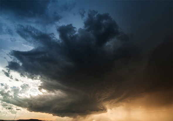
On June 1, 2015, photographer Nicolaus Wegner was in South Dakota and saw a rare sight: a stationary supercell.
Normally these system move, blown by winds, but this huge rotating thunderstorm squatted over the landscape like an angry god. He shot a time-lapse video of it that is stunning. Stunning.
Make this full screen, and turn up the volume.
Holy. WOW.
The whole system is called a supercell, and the rotating structure is called a mesocyclone. I’ve described this before:
A supercell is a rotating thundercloud; the spinning vortex in the middle is called a mesocyclone. Conditions need to be just so to create one. First you need a wind shear, where wind blows faster in one spot than another, so a blanket of air is flowing over another one. This sets up a rolling vortex, a horizontally rotating mass of air like the way a wave breaks when it gets to a beach. An updraft then lifts that vortex, which then spins vertically.
The warmer air in the vortex rises; this is called convection. If there’s a boundary layer of air above it, called a capping layer, it acts like a lid, preventing the vortex air from rising. It builds up power and can suddenly and explosively grow to a huge size. Wikipedia has a good description and diagrams of how this works.
The colors are amazing. As white light from the Sun goes through the cloud, two things happen: Red light is absorbed by water, and blue light gets scattered away from the direction of the Sun. So when you look toward the Sun, you see less blue, making it look red, and when you look toward the cloud itself the red light from the Sun is absorbed, making it look blue. The presence of hail sometimes makes the cloud look deep green or teal; the reason for this isn’t completely understood.
We had something similar to this that sat over northern Colorado a week ago, spawning a tornado in my area, as well as a lightning storm the likes of which I have never experienced; we had continuous lightning and thunder for hours. It was surreal, awe-inspiring, and something I never, ever want to see again.
I am fascinated by weather, and love weird and wild clouds. But unless I can be as far as Wegner was from the supercell he recorded, I’ll be happy enough to watch the videos instead of living through another one.
More storm videos and photos by Nicolaus Wegner and others:


