[Note: At the bottom of this post is a gallery of amazing NASA satellite images of the Earth!]
I need to make a list of the stuff I love about science, because I keep coming up with more. This time, it's how surprising the Earth can be, even though we live on the dang thing.
Phil Plait writes Slate’s Bad Astronomy blog and is an astronomer, public speaker, science evangelizer, and author of Death From the Skies!
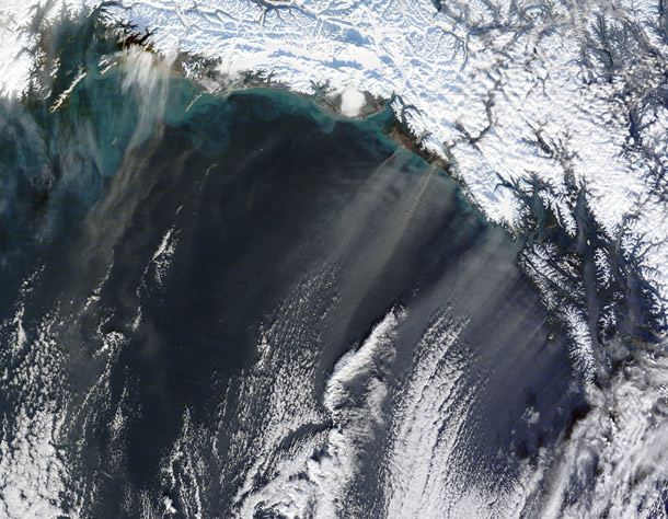
For example, when I think of dust storms, I think of China and the Sahara or maybe the Dust Bowl in the U.S. I certainly don't think of Alaska! But then, NASA's Terra satellite set me straight:
[Click to 49thstatenate.]
Check that out! An actual series of dust storms blowing off the coats of Alaska! The cause was obvious in retrospect: as billions of tons of glacier flow languidly across the landscape, they crush the rocks underneath into powder called -- get this -- glacial flour. This gets deposited as mud underneath the glacier. When the glacier recedes a bit, the mud dries, and the wind can blow it away.
Tadaa! Dust storms off the coast of Alaska. Maybe Marian knows all about these, but for me, that's a first.
The stuff I learn from NASA. Man.
Here are some other amazing images of the Earth from space! Use the thumbnails and arrows to browse, and click on the images to go through to blog posts with more details and descriptions.
Bad Astronomy Gallery
(click any image to see it full size)
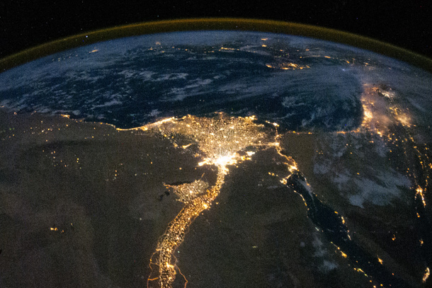
ISS view of the Nile
The Nile Delta, as seen by the crew on board the International Space Station.
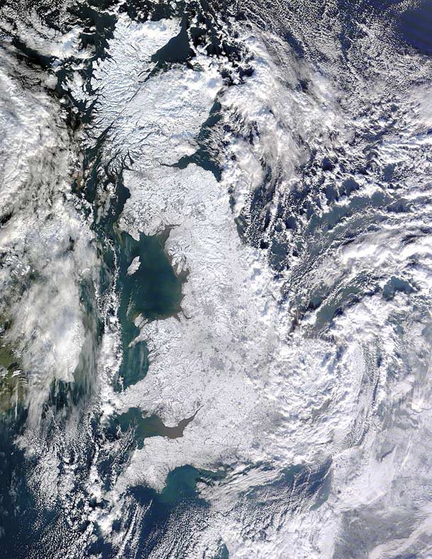
Hail, Brittania!
A bitter winter grips the UK.
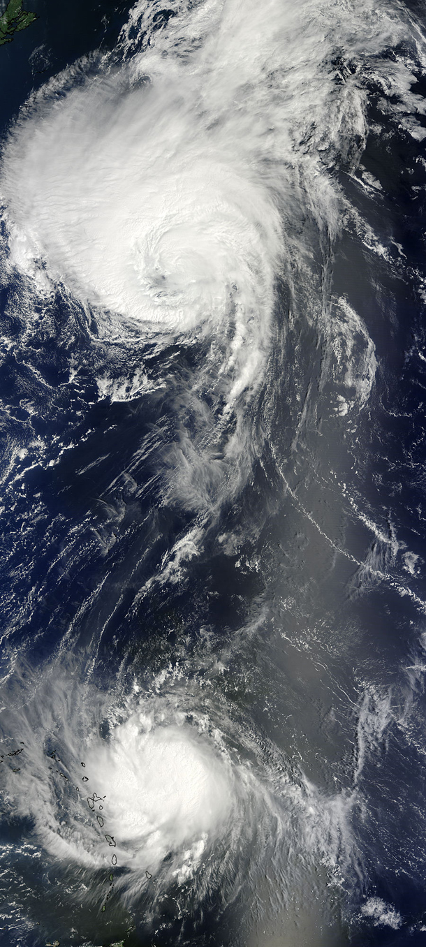
Two simultaneous Atlantic hurricanes
Two huge hurricanes surged across the Atlantic at the same time, as seen in this view from summer 2010.
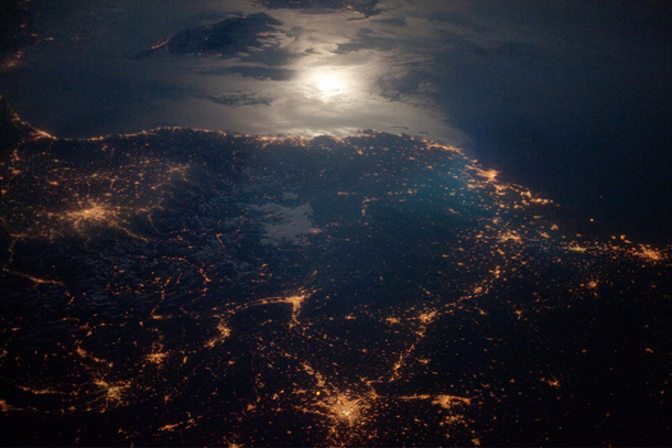
France from above
France at night, as seen by the International Space Station crew.
The Great Midwest Storm of October 2010
This incredible low-pressure system blew across the US in 2010.
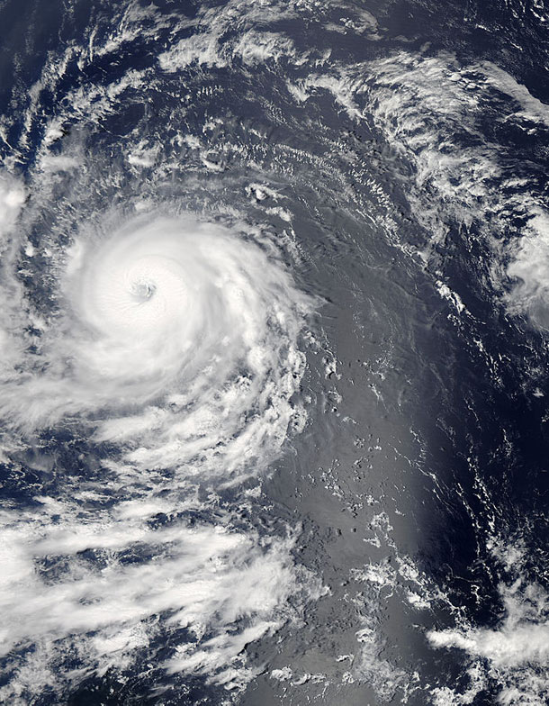
Hurricane Eyegore... I mean Igor!
A giant hurricane in the Atlantic, captured by a NASA satellite.
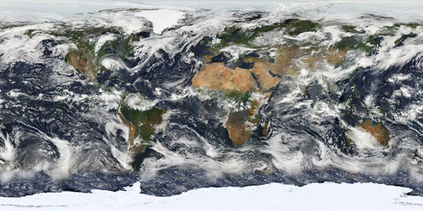
Global cloud patterns
NASA's Terra satellite was use to make this whole-Earth cloud map.
A dust storm... in Alaska?
Dust from glacially crushed boulders blows into the ocean off the coast of Alaska.
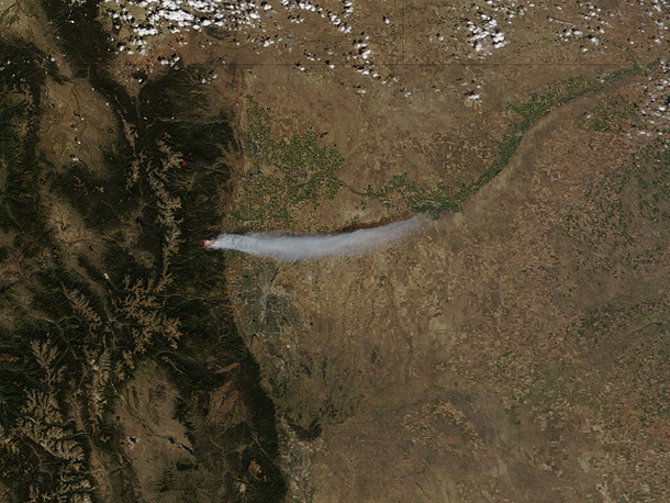
Boulder fire, summer 2010
A wildfire broke out in the summer of 2010 just west of Boulder, Colorado, and the ash plume blew almost due east.
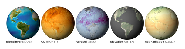
Different eyes give different views of the Earth
Using different instruments, satellites can measure atmospheric aerosol levels, ground elevations, and more.
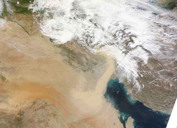
Sandswept planet
Sand storms blow in the Middle East.
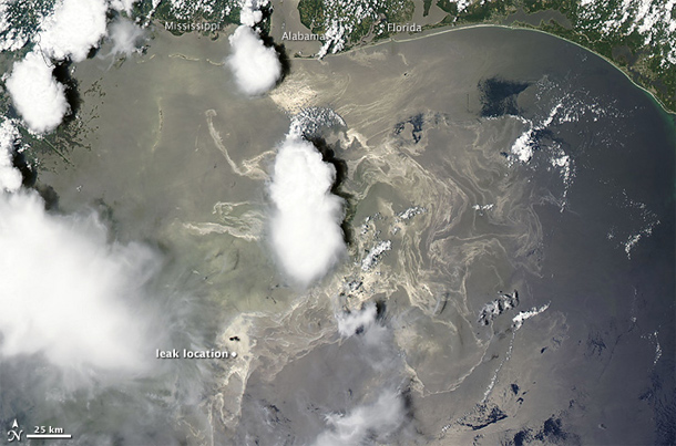
The Oil leak in the Gulf of Mexico, June 2010
The huge BP oil leak in the Gulf of Mexico in 2010 was tracked from space. This really brings home, ironically, just how awful this event was.
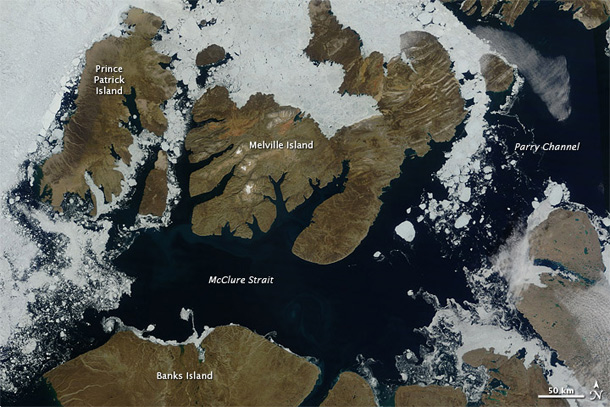
The receding sea ice
Satellites are used to track the growth and decay of sea ice at high latitudes.