The Vault is Slate’s history blog. Like us on Facebook, follow us on Twitter @slatevault, and find us on Tumblr. Find out more about what this space is all about here.
This 1936 map of Washington, D.C. pinpoints residencies that had produced kids recently designated “juvenile delinquents.” The data for the map came from the District of Columbia’s Juvenile Court. The red marks on the map, which look similar from afar, are shaped differently: Stars mean “white girls”; squares are for “white boys”; circles indicate “colored girls”; and triangles denote “colored boys.”
Those responsible for printing this D.C. map may have been responding to recent work by Clifford R. Shaw, a sociologist whose book Delinquency Areas (1929) tracked 60,000 Chicago youths, mapping their addresses and trying to understand how the geography of the city might be contributing to truancy, delinquency, and criminality.
Shaw and his collaborator Henry D. McKay believed that the presence of clusters of delinquents in certain areas of the city—lower-income neighborhoods that were close to industry and commerce—indicated that it was environment, and not personality, that caused delinquency. Evaluating an updated version of their work in 1942, Shaw and McKay wrote:
It would appear from the findings of this study that successful treatment of the problem of delinquency in large cities will entail the development of programs that will seek to effect changes in the conditions of life … Diagnosis and supervision of individual offenders probably will not be sufficient to achieve this end.
Since the time of Shaw’s and McKay’s work, contemporary sociologists have taken issue with their geographical approach’s inability to tell us more about the culture of the neighborhoods being assessed, or about the lives of the nondelinquent kids who lived there.
I first saw this map on the blog Ghosts of DC. Click on the image to reach a zoomable version, or visit the map’s page in the Harvard Map Collection’s digital library.
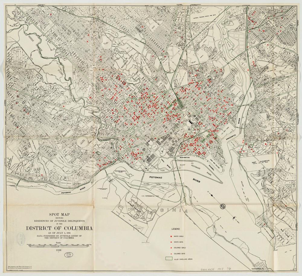
Image via Harvard Map Collection’s Digital Maps.