The Vault is Slate’s history blog. Like us on Facebook, follow us on Twitter @slatevault, and find us on Tumblr. Find out more about what this space is all about here.
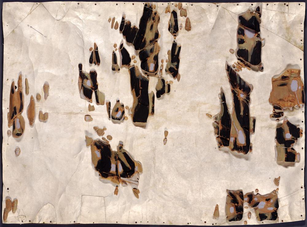
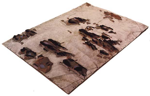
Inuit hunter Silas Sandgreen made this map for the Library of Congress in 1925. The map represents the Crown Prince Islands, in Disko Bay, on the west coast of Greenland. Sandgreen carved driftwood to signify the islands’ landmasses, painting the material to mark areas of rocks and vegetation. The driftwood is sewn to sealskin.
An item about the map that ran in Popular Science in September 1933 contended that Sandgreen had “never seen a map” before carving this—an assertion that played upon American fascination with the “primitive” nature of Inuit lives.
However, in 1948, an editor for the cartography journal Imago Mundi noted that Inuit often made such maps for their own use. In other words, even if he’d never seen a map on paper, Sandgreen’s map emerged from a historical tradition of indigenous cartography.
Inuit also carved portable wooden “maps” to be used while navigating coastal waters. These pieces, which were small enough to be carried in a mitten, represented coastlines in a continuous line, up one side of the wood and down the other. The maps were compact, buoyant, and could be read in the dark.
Library of Congress
Library of Congress