The Vault is Slate’s history blog. Like us on Facebook, follow us on Twitter @slatevault, and find us on Tumblr. Find out more about what this space is all about here.
This map was sold as a folded-in illustration in an 1896 Cycler’s Guide and Road Book of California, which also included seven smaller sectional maps, a list of hoteliers prepared to offer cyclists’ rates, and a directory of “agents and repairers” who might furnish up-to-date information on road conditions.
The advertisements around the border of the map show how many San Francisco businesses had sprung up around cycling by 1896. The 1890s were the high point of American interest in the new sport, as the “safety” bicycle replaced the more dangerous “boneshaker” and “high wheeler” models. In a 2012 interview, historian David V. Herlihy noted that American factories produced about 2 million bikes a year at the height of the ‘90s craze—“an astonishing number at the time, given the primitive state of mass production.”
The red lines on this map represent potentially cycleworthy roads. At first glance, it seems impressive that a cyclist could transverse almost the entire large state of California before the turn of the 20th century. And some early cyclists were surprisingly ambitious, given the roughness of most roads. By 1896 two cyclists had already taken highly public “trips around the world.”
But the notation system, with initials indicating road condition, shows that many of the roads were “Poor” or “Very Poor,” not to mention “Hilly” or “Mountainous.” These would be trips that would require a certain level of preparation and gumption. The rigors of taking the “Poor, Mountainous” route through Yosemite National Park or tackling the “Very Poor, Mountainous” trail through the rugged terrain of present-day Los Padres National Forest may have been more than most 1890s cyclists were willing to risk.
Click on the map to reach a larger, zoomable image, or visit the item’s page on the Library of Congress’ American Memory site.
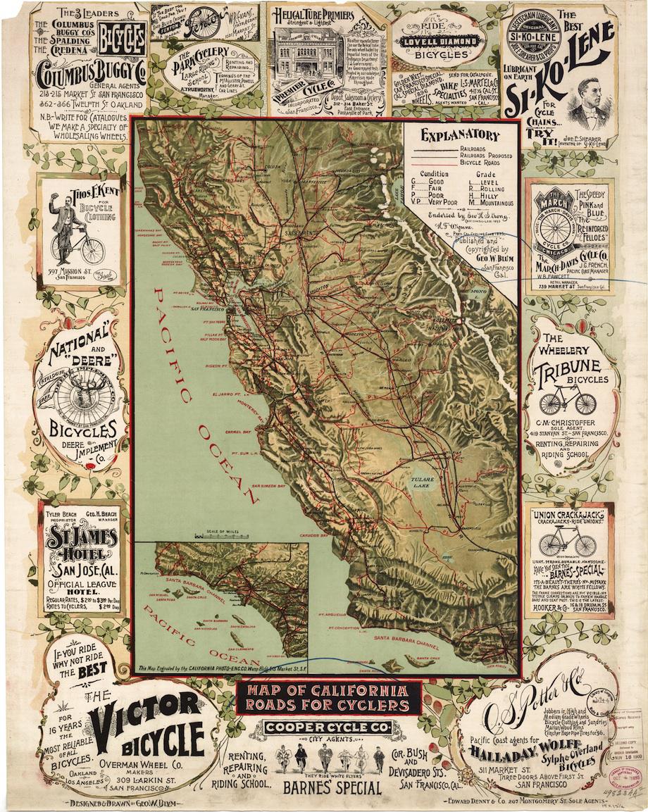
“Map of California roads for cyclers,” George W. Blum. Library of Congress American Memory Map Collection.
See more of Slate’s maps.