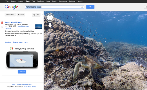
Apple Maps might drive you off the road and into the ocean, but Google Maps just launched underwater Street View in case you’d like to see the sights but stay dry.
Small teams of divers spent six months collecting images using cameras mounted on underwater scooters and then stitched them together to create 360-degree panoramas. So far, they’ve mapped the Great Barrier Reef, two sites in Hawaii, and one site in the Philippines, with much more to follow.
Google’s goal is to create a comprehensive virtual map of the oceans while educating people about ocean conservation.
Jenifer Austin Foulkes, a manager with Google’s Ocean Program, told Boing Boing: “There’s a great quote about conservation from ocean researcher Sylvia Earle—‘With knowing comes caring, and with caring, there’s hope.’ “