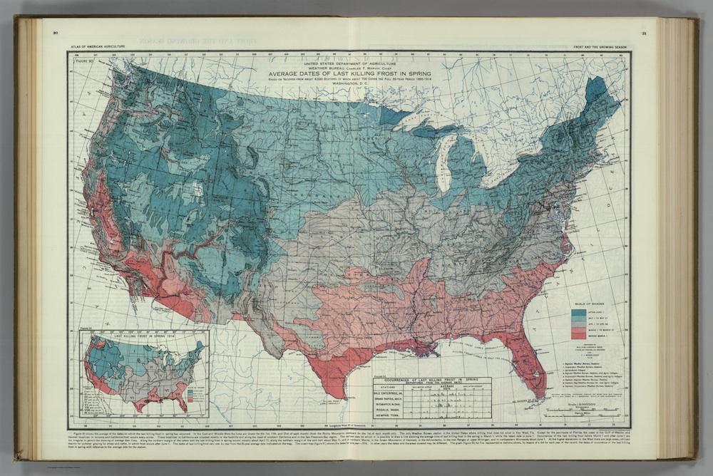
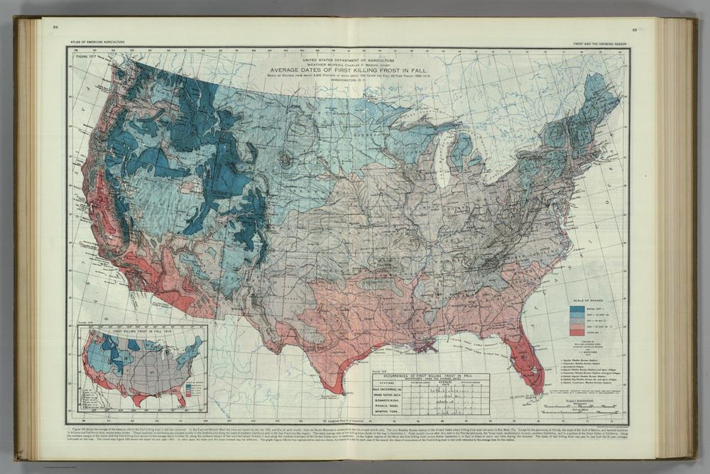
Published in a 1936 Atlas of American Agriculture, put together by the United States Department of Agriculture, these 1916 maps of the average dates of first killing frosts in fall and last killing frosts in spring were initially intended to help farmers plan their planting schedules. Now, the maps offer a rough gauge showing how much these dates have shifted over a century.
The preparers of these maps, William Gardner Reed, Charles Franklin Brooks, and F.J. Marschner, compiled data from a then-relatively-new network of Weather Bureau stations and agricultural colleges. The trio notes that of 4,000 such stations, 700 were able to offer data that covered every year between 1895 and 1914. Insets show dates of the first and last killing frosts in the year of 1914.
On a website charting indicators of climate change, the Environmental Protection Agency offers a few graphs showing how the growing season in the continental United States has lengthened between 1895 and 2015, with most of the upswing taking place in the past 30 years. While stipulating that a lengthening growing season could have positive effects on yield for some farmers, the EPA notes that “overall, warming is expected to have negative effects on yields of major crops.” A long season “could limit the types of crops grown, encourage invasive species or weed growth, or increase demand for irrigation.”
Of course, a shift in frost dates affects the life cycles of nonagricultural flora and fauna, as well. Longer summers, writes the EPA, could change “the function and structure” of a region’s ecosystems, encouraging some species to reproduce more vigorously, and inhibiting the success of others.
Click on the images below to reach zoomable versions, or visit William Reed Gardner’s page in the David Rumsey Map Collection.
David Rumsey Map Collection
David Rumsey Map Collection