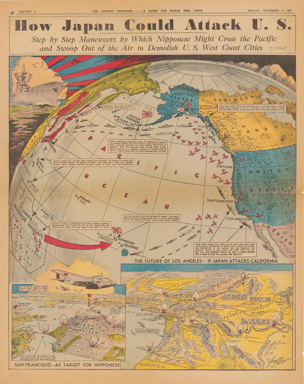
Four years before the attack on Pearl Harbor, the Los Angeles Examiner published this full-page map by artist Howard Burke, outlining a potential Japanese strategy for attacking the West Coast and “demolishing” its cities. The map is online as part of the Cornell University Library’s Persuasive Cartography digital collection.
The Examiner, founded in 1903, was a Hearst newspaper; in 1937, it was published both on weekdays and in a weekend morning edition. This map came into Los Angeles households on a Sunday morning, describing the way that Japan—which had recently invaded China—could extend its influence over the Western United States. Insets illustrated how Los Angeles could be cut off from the rest of the country with strategic bombing of mountain passes and how its key utilities—water supply and electricity—could be easily controlled by an invading army.
The Examiner thought the main thrust of a Japanese offensive might come from the north. While “crippling or annihilating” the American fleet at Pearl Harbor would be a key part of the plan, allowing Japan to “speed capital ships that would send 16-inch shells screeching to wreak bloody swaths of terror and destruction at Los Angeles and San Francisco,” the southern front would “only be a smoke-screen for a main attack via Alaska and Seattle.”
The Examiner’s fearmongering purple prose is intriguing, given Hearst newspapers’ general support for American neutrality in overseas conflicts during the 1930s. Collector P.J. Mode notes that the Hearst papers were notably anti-Japanese throughout the early 20th century; “Hearst didn’t coin the phrase ’yellow peril,’ but he used it early, often and forcefully.”
John Ptak, whose blog first informed me of this map, has identified several other times when American media hypothesized about a breach of the home front during the runup to World War II (and during the war itself). The popularity of the trope notwithstanding, Germany and Japan didn’t actually have the resources to mount such a costly invasion.
Click on the image below to reach a zoomable version, or visit the map’s page in Cornell’s digital collections.
Persuasive Cartography: The PJ Mode Collection, Cornell University Library