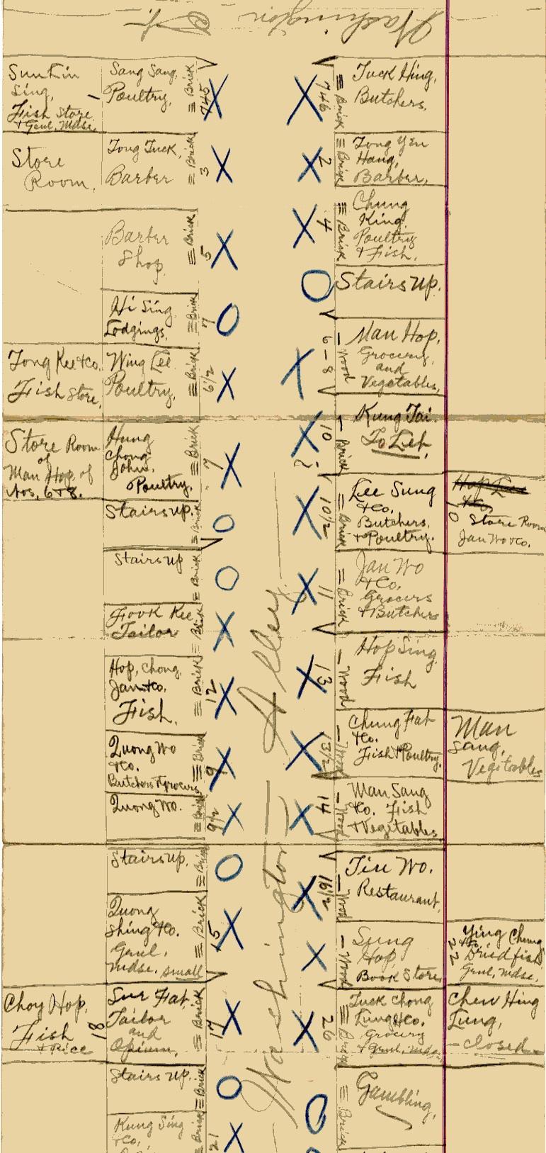
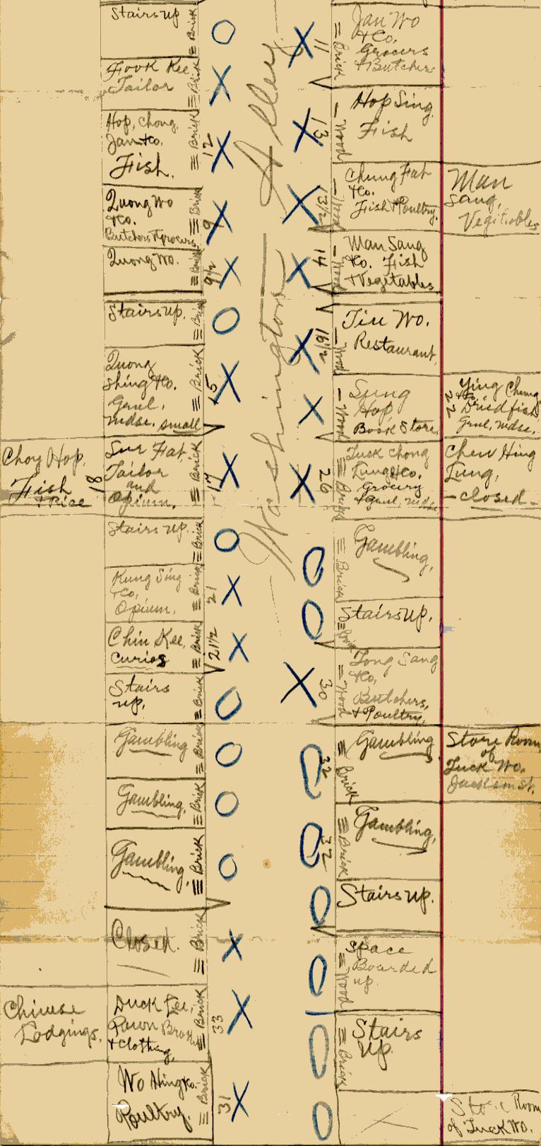
Walking through San Francisco’s Chinatown in 1894, immigration officer John Lynch recorded the nature of the small businesses lining the ethnic enclave’s streets and alleys. The National Archives has digitized the maps Lynch and other immigration investigators used to track the fish vendors, tailors, and restaurants found along streets like Washington Alley, which is mapped below.
The map shows how some of the city’s Chinese American residents supported themselves in the years after the 1882 Chinese Exclusion Act was passed. Because the document was used as part of an immigration investigation, it also illustrates how legal strictures tied to socioeconomic status shaped the ability of Chinese immigrants to enter and stay in the late-19th-century United States.
The Exclusion Act and its extension (the 1892 Geary Act) allowed exemptions for people from certain professional classes the American government thought were desirable: merchants, teachers, government officials. The immigration officials who walked the streets of Chinatown in the 1890s were checking to see if people who had represented themselves as “merchants” truly fit the description. “An applicant had to be certified through investigation as an owner or official partner with at least $1000 interest in a recognized mercantile firm, where he performed no “manual labor,’” the National Archives’ educational site DocsTeach writes.
DocsTeach also offers this page rounding up Lynch’s maps for other San Francisco streets.
National Archives
National Archives