The Vault is Slate’s history blog. Like us on Facebook, follow us on Twitter @slatevault, and find us on Tumblr. Find out more about what this space is all about here.
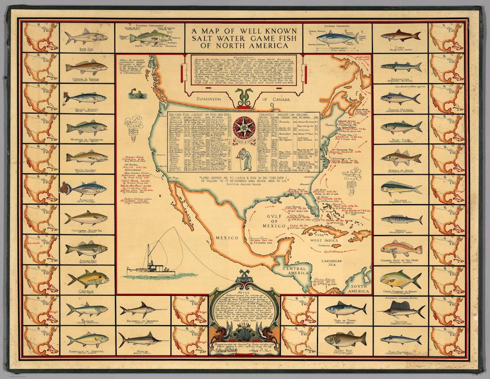
This 1936 pictorial map of saltwater fish of North America was originally sold as a collector’s item; 1,000 were produced. The borders of the map incorporate 26 paintings of fish, along with individual maps designating their accustomed coastal ranges. Two anatomical drawings of fish flank the map’s title. A list of then-current record-setting catches dominates the central map and its coastlines; most of these records were set in the 1920s and 1930s.
Joseph Patterson Sims, the artist who designed this map, was an architect from Philadelphia whose hobbies were lithography and cartography. (Sims consulted with a scientist at the Academy of Natural Sciences of Philadelphia in creating this map.) During the 1930s, Sims also produced a lithographed “Horse Map of the World,” which, like this fisheries map, sold as a limited edition.
The National Oceanic and Atmospheric Administration now designates many species on this map—the Atlantic bluefin tuna, the sailfish, the amberjack, the marlin, the swordfish—as overfished, or in danger of becoming so. (Compare Sims’ fish with those on NOAA’s most recent Stock Status map, updated as of June 30 of this year.)
Click on the map below to reach a zoomable version, or visit the item’s page on the David Rumsey Map Collection’s website.
David Rumsey Map Collection.