The Vault is Slate’s history blog. Like us on Facebook, follow us on Twitter @slatevault, and find us on Tumblr. Find out more about what this space is all about here.
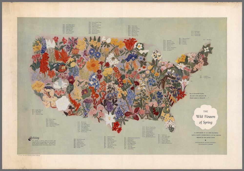
This 1955 map of “The Wild Flowers of Spring,” a collaboration between a botanist and an abstract expressionist painter, locates early-blooming American wildflowers geographically. The flowers are numbered and lettered, with common names appearing around the perimeter of the map.
The collaborators who produced this map were both Philadelphians, and polymaths in their respective fields. Edgar Wherry, who contributed the data for the map, was trained as a chemist and a mineralogist before his hobby of photographing and printing images of plants morphed into an academic position as a botanist. He helped establish a state wildflower preserve in Pennsylvania and published a guide to flowers in 1948. The map’s designer, Clayton Whitehill, was a painter and professor of art who also wrote an influential 1947 book on typography, The Moods of Type.
Many people shared Wherry’s interest in wildflowers in the first half of the twentieth century. The national Wild Flower Preservation Society of America, founded in 1902, was the first of a wave of national and local conservation groups established in those years—its members might have been likely buyers of this decorative map.
Click on the image below to reach a zoomable version, or visit the map’s page in the David Rumsey Map Collection.
David Rumsey Map Collection.