The Vault is Slate’s history blog. Like us on Facebook, follow us on Twitter @slatevault, and find us on Tumblr. Find out more about what this space is all about here.
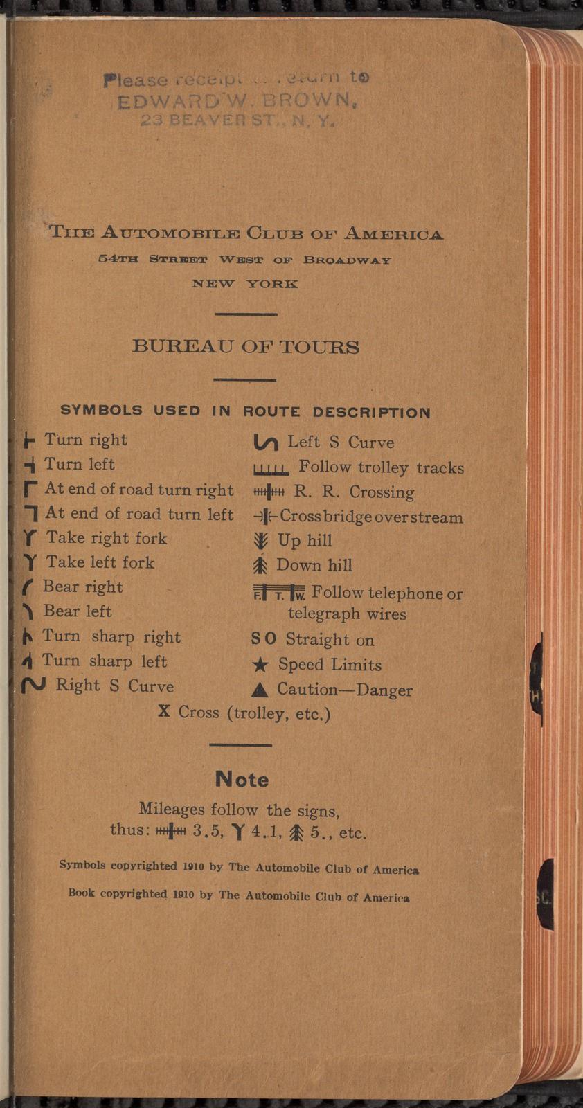
This tour book, published by the Automobile Club of America in 1910, offered detailed directions for motorists looking to navigate the New York and New England areas. The book used a copyrighted language of symbols to indicate directionality, terrain, and local rules of the road. Its sections are marked with black edging, so that a navigator could thumb through easily on the go.
The New York-based ACA, one of several local clubs that together made up the young American Automobile Association, was founded in 1899. The group was flush with wealthy and influential members; John Jacob Astor was a long-time benefactor. In 1912, the Club’s Twelfth Annual Banquet served almost a thousand people, and President Taft was the guest of honor.
In the introduction to this tour book, the ACA laid out its objectives: to sponsor development of both automobile and other technologies that used gasoline engines; to “secure rational legislation” relating to automobile use; and to “encourage the construction of good roads and their maintenance.”
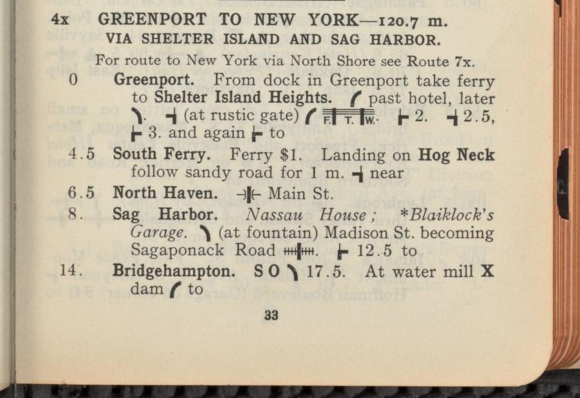
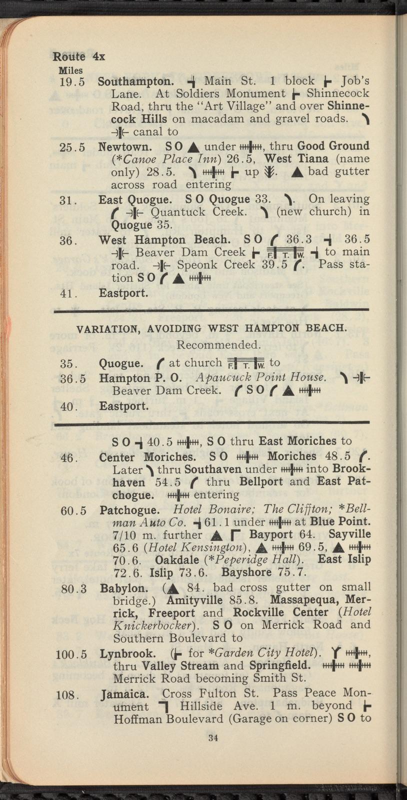
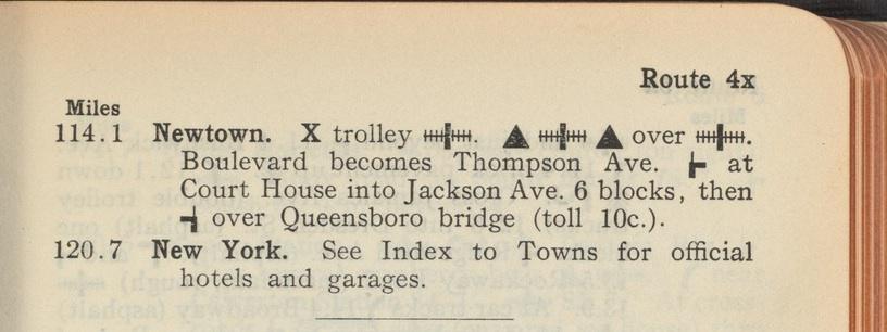
The route below—a drive from the town of Greenport, on Long Island’s North Fork, to New York City—shows how the book used symbols along with descriptions of landmarks (“bad gutter across road”) to guide motorists navigating a complicated series of local byways.
New York Public Library.
New York Public Library.
New York Public Library.
New York Public Library.