The Vault is Slate’s history blog. Like us on Facebook, follow us on Twitter @slatevault, and find us on Tumblr. Find out more about what this space is all about here.
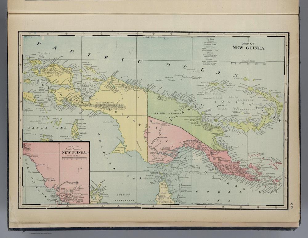
This map of New Guinea, from George Cram’s 1901 atlas, shows the extent to which, even in the first years of the 20th century, the interior of the island remained completely unknown to foreign surveyors.
Cram’s map, drawn from charts of the British Royal Geographical Society, marks the midpoint of New Guinea’s gradual progression from unmapped to mapped. Early 19th-century maps leave the interior of the island completely empty, an arresting terra incognita. By 1925 the blank expanses on earlier maps were gradually filled, as the interior was increasingly explored. Turn-of-the-century maps like this one show the first initial forays inland, often along rivers, that began tentatively mapping out the basic features of New Guinea’s geography.
Portugese navigators first sighted New Guinea in the 16th century. In the 17th century, the Dutch East India Company took control of the western half of the island, an arrangement maintained until that portion became part of Indonesia in 1963. In the late 19th century, Germany, an imperial late-comer eager to find territories left to colonize, staked its claim. The northeast quadrant of the island became Kaiser Wilhelm Land in 1884, while in response the British annexed the southeast quadrant as a protectorate in 1888. (The eastern half of the island is now the independent state of Papua New Guinea.)
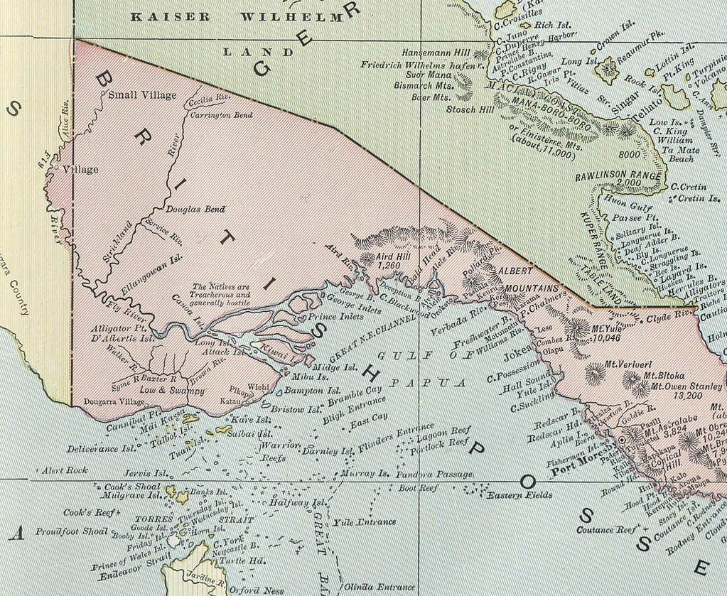
In addition to everything left blank on this 1901 map, a close-up view reveals the extent to which the naming practices of early European explorers reinforced their sense of the island’s wild and hostile character. Highlights include Deliverance Island, Cannibal Point, Alligator Point, Attack Island, Pandora Passage, Deception Bay, the simply named “Village,” and the slightly modified “Small Village.” Additional notes written on the map include “Low & Swampy” and “The Natives are Treacherous and generally hostile.” (Click on the image above to reach a zoomable version, or visit the map’s page in the David Rumsey Map Collection.)
New Guinea first came to the attention of many Americans during World War II. In 1942, Japan invaded the island, and American forces under Douglas MacArthur counterattacked. The cartoon map “Yank’s New Guinea,” printed in the Army’s official publication Yank Down Under in 1944, shows how—even as the military drew up increasingly precise maps of the island’s geography—its population remained a foreboding blank in the minds of soldiers serving there during the war.