The Vault is Slate’s history blog. Like us on Facebook, follow us on Twitter @slatevault, and find us on Tumblr. Find out more about what this space is all about here.
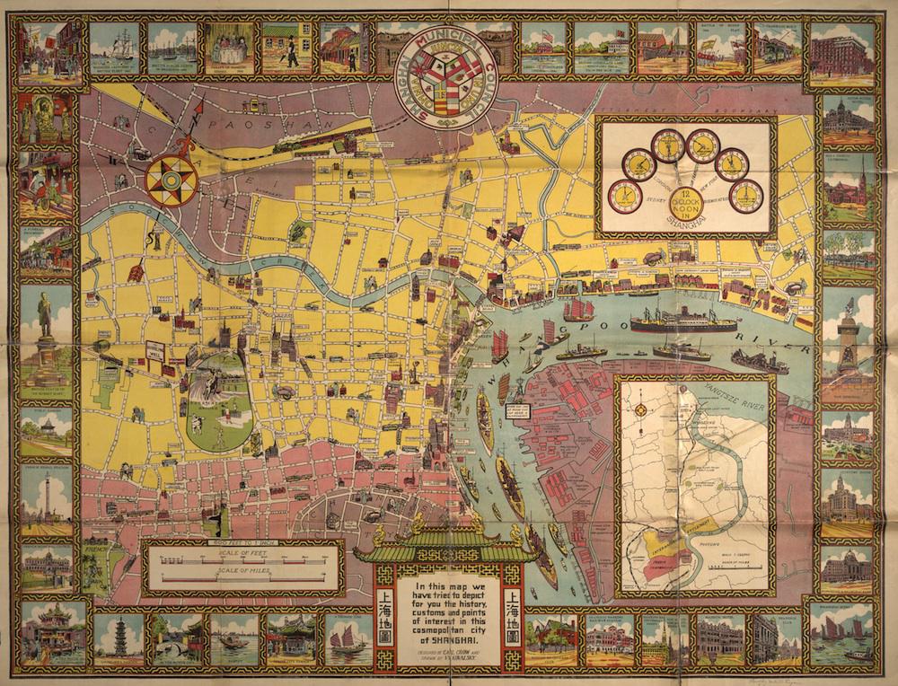
Carl Crow, an American journalist and ad man who lived in Shanghai for 25 years, designed this historical map of the city in 1935. Crow was a ceaseless promoter of China in general and Shanghai in particular, and the map illustrates his vision of a “cosmopolitan” city where American, French, British, and Chinese cultures mixed.
Since its forcible opening in the middle of the 19th century, Shanghai, a “treaty port” designated for Chinese-Western trade, had been host to self-governing foreign settlements. The Shanghai Municipal Council, composed of representatives from these settlements, published this map, and the vignettes ranging around the borders of the map illustrate a polycultural history, juxtaposing portraits of a tea house and a pagoda with images of the French signal station and a buttoned-down statue of British diplomat Sir Robert Hart.
Crow, who had written several travel books about China, would go on to publish the bestseller 400 Million Customers: The Experiences, Some Happy, Some Sad of an American in China and What They Taught Him (1937). This book was a humorous how-to manual for doing business in the Middle Kingdom, merged with what historian Stephen R. MacKinnon calls a “self-deprecating melange of stories” about Crow’s decades in China.
Click on the image below to reach a zoomable version, or visit the map’s page in the Boston Public Library’s online collections.
Norman B. Leventhal Map Center at the Boston Public Library.