The Vault is Slate’s history blog. Like us on Facebook, follow us on Twitter @slatevault, and find us on Tumblr. Find out more about what this space is all about here.
This map, published in October 1940, was used by German troops on leave in occupied Paris. The city, under German control since June of that year, served as a relatively calm location for soldiers to take R&R. Distributed by the city’s military governor, the map directed visiting troops to take in the traditional sights of Paris: “Eiffelturm,” “Notre-Dame,” “Luxembourg Palast.”
Writing in their book A History of the Twentieth Century in 100 Maps, Tim Bryars and Tom Harper point out that “no sites associated by the occupation are marked” on the straightforward tourist map. Bryars and Harper see the Gothic script—a style of font associated with Germany—as “a sufficient statement of control.” One of the landmarks included on the map is a memorial to a past French military victory over Prussia, and Bryars and Harper suggest that troops whose fathers and grandfathers were veterans of that conflict might have visited the site in celebration: “The defeats of the past had been expunged by the decisive victory in the present.”
At the time of the map’s publication, the more vulnerable citizens of Paris were beginning to feel the impact of the occupation. In a timeline of the occupation of the city, historian Ronald C. Rosbottom notes that in September and October 1940, the Germans and the collaborating Vichy government issued their first anti-Semitic edicts, disallowing Jewish citizens from the army and from owning businesses, and began an official census of the Jewish population of the city. October also marked the first roundup of French Communists. This was the beginning of a cascade of decrees, roundups, and deportations that would follow in the years to come.
Click on the image below to reach a zoomable map.
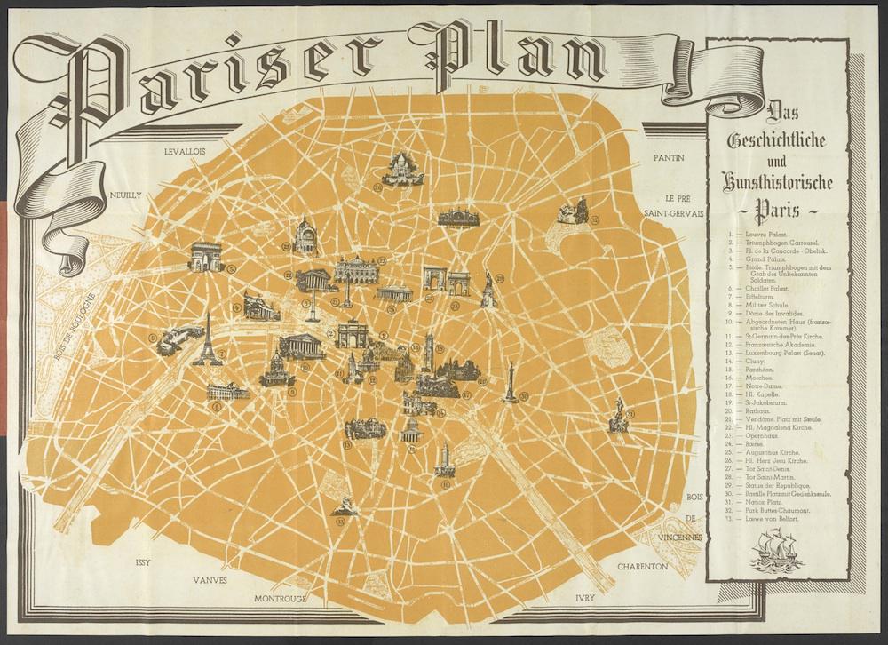
A History of the Twentieth Century in 100 Maps / collection of Tim Bryars.