The Vault is Slate’s history blog. Like us on Facebook, follow us on Twitter @slatevault, and find us on Tumblr. Find out more about what this space is all about here.
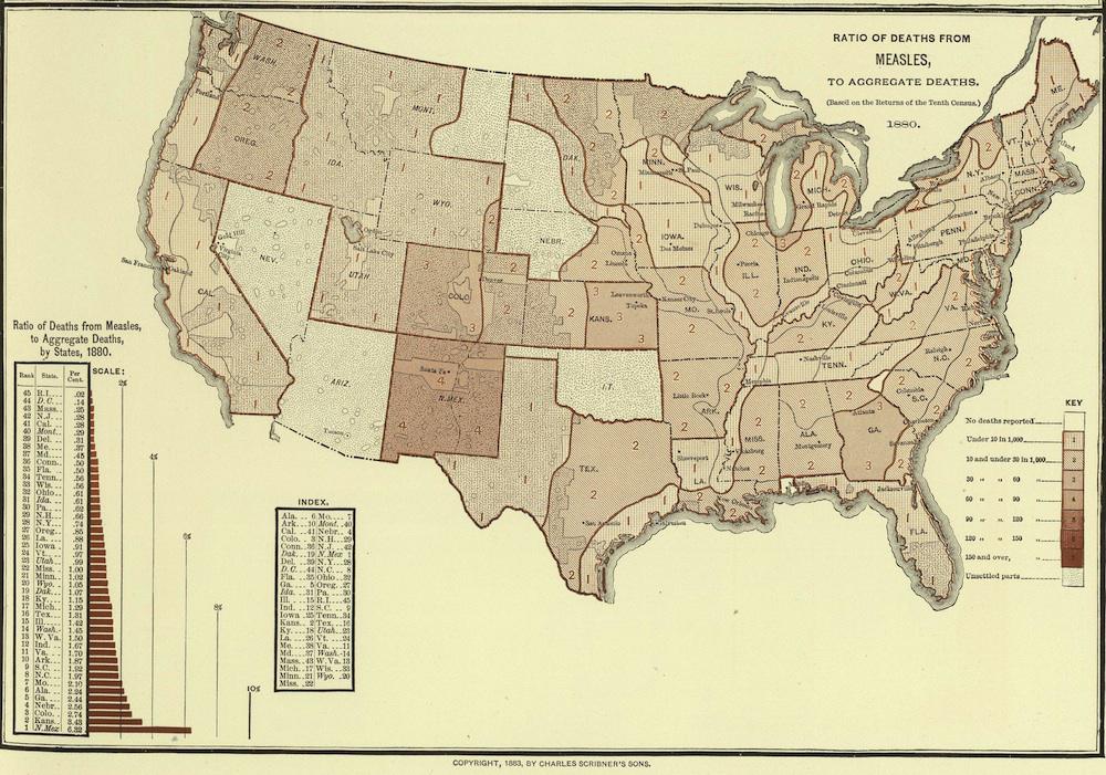
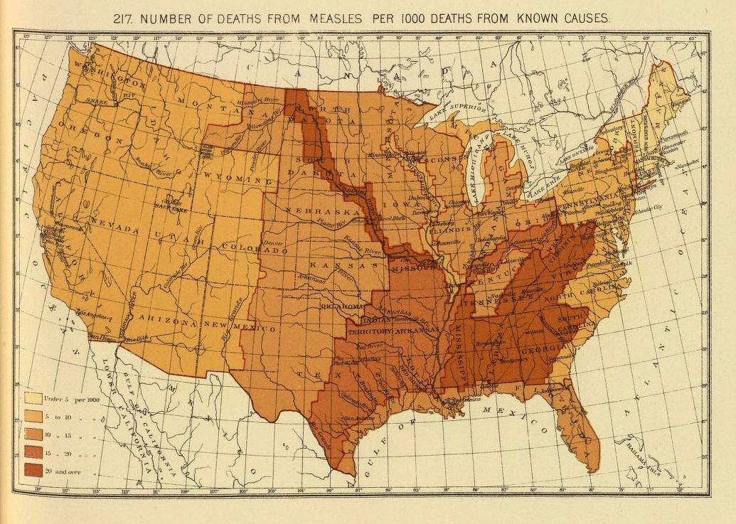
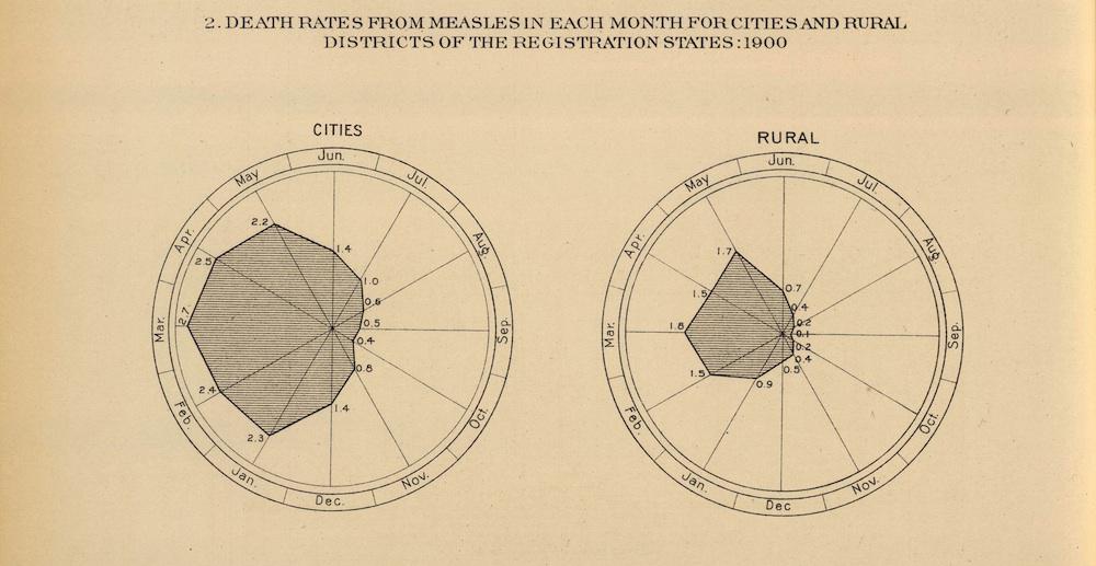
These maps of measles mortality appeared in three late-19th-century statistical atlases published by the Census Office. Experiments in data visualization, the atlases are modern in their scope and ambition. Since they were compiled in a time before the availability of vaccines for most childhood diseases (with smallpox being the exception), they are a good record of the former pervasiveness of measles.
In a brief history of the disease, the Centers for Disease Control writes that between 1953 and 1963, when the measles vaccine became available, “nearly all children got measles by the time they were 15 years of age.” Yearly, “400 to 500 people died, 48,000 were hospitalized, and 4,000 suffered encephalitis (swelling of the brain) from measles.” (Writer Roald Dahl’s daughter, who died in 1962 and is the subject of this 1988 Dahl letter urging parents to vaccinate, was afflicted by this complication.)
While late-19th-century medicine didn’t yet have a vaccine for the disease, doctors knew that it was easily transmissible. “Measles is a very infectious disease,” warned Dr. John Dewar in an 1890 book written for mothers and titled What Ails The Baby? “If a child be only taken into a room for a very short time, where another child is suffering from measles, it is almost certain to take it.” The 1898 map, second below, shows a pattern of measles deaths that is strikingly aligned with the course of the Mississippi River, illustrating how transmission could have been aided by river travel.
Click on the images below to reach zoomable versions, or see their pages on the David Rumsey Map Collection site.
David Rumsey Map Collection.
David Rumsey Map Collection.
David Rumsey Map Collection.