The Vault is Slate’s history blog. Like us on Facebook, follow us on Twitter @slatevault, and find us on Tumblr. Find out more about what this space is all about here.
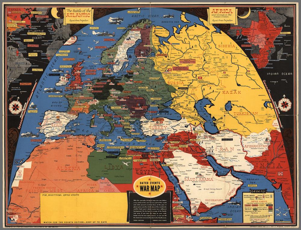
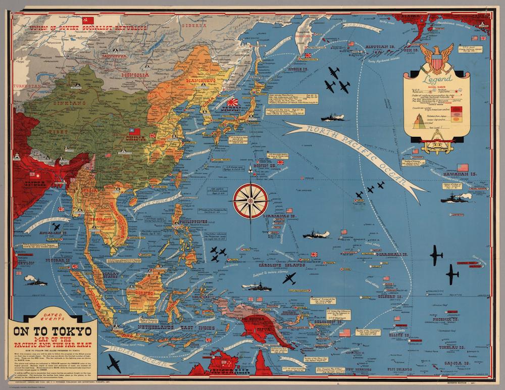
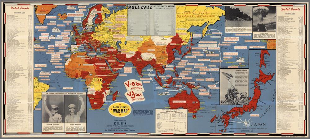
These bright Dated Events War Maps, issued in 1942, 1944, and 1945, are by Toronto artist Stanley Turner. Other Turner war maps digitized by the David Rumsey Map Collection are also dated between 1942 and 1945. Each offers readers a packed visual guide to the recent happenings of the global war.
The Turner maps in Rumsey’s collection were printed by advertising agency C.C. Petersen. The agency appears to have licensed the works to businesses in Canada and the United States. These, in turn, branded the maps with their own logos, giving them out as courtesies to customers. So, for example, the 1945 map, issued in a celebratory spirit following V-J Day, was distributed “Compliments of Kile’s, Corner Front and LaSalle Streets, Berwick, Pennsylvania, to Service Men and Their Families.”
Writing about the maps that American cartographer Richard Edes Harrison made for Fortune Magazine during the war, historian Susan Schulten points out that World War II created a frenzy for map-buying:
The urgency of the war, coupled with the advent of aviation, fueled the demand not just for more but different maps, particularly ones that could explain why President Roosevelt was stationing troops in Iceland, or sending fleets to the Indian Ocean.
Harrison innovated to meet this demand, drafting maps that stepped outside of the familiar bounds of the Mercator projection. Turner, for his part, experimented with equal-area projection (as seen on the 1942 map below). He also responded by maximizing the data available in a particular map, making each serve to convey geographical, chronological, and even anthropological information about unfamiliar theatres of war.
Click on the images below to reach zoomable versions, or visit the maps’ pages in the David Rumsey Map Collection.
David Rumsey Map Collection.
David Rumsey Map Collection.
David Rumsey Map Collection.