The Vault is Slate’s history blog. Like us on Facebook, follow us on Twitter @slatevault, and find us on Tumblr. Find out more about what this space is all about here.
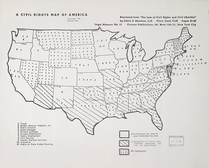
Using this simple 1949 map, you can see how varied civil rights law was across the nation before the passage of the federal Civil Rights Act in 1964.
States without stripes or polka-dots—on the West Coast, or in the Midwest, Mid-Atlantic, and southern New England—had laws in place forbidding discrimination. Striped states in the South and Southwest enforced or permitted segregation. States in the Mountain West and northern New England had no laws in place, and bear polka dots to signify this lack. Numbers indicate the passage of laws governing segregation in particular arenas of public life, either supporting or condemning the practice (depending on the status of the state).
The map appeared in The Law of Civil Rights and Civil Liberties: A Handbook of Your Basic Rights, by lawyer Edwin S. Newman, published by Oceana Publications in 1949. Oceana printed legal reference books and pamphlets geared to help a popular audience understand topics relevant to daily life, like divorce, inheritance, and immigration. The map, then, would have had a practical use for people looking to move from state to state, take a road trip, or do business across state lines.