The Vault is Slate’s history blog. Like us on Facebook, follow us on Twitter @slatevault, and find us on Tumblr. Find out more about what this space is all about here.
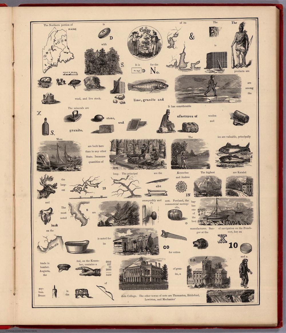
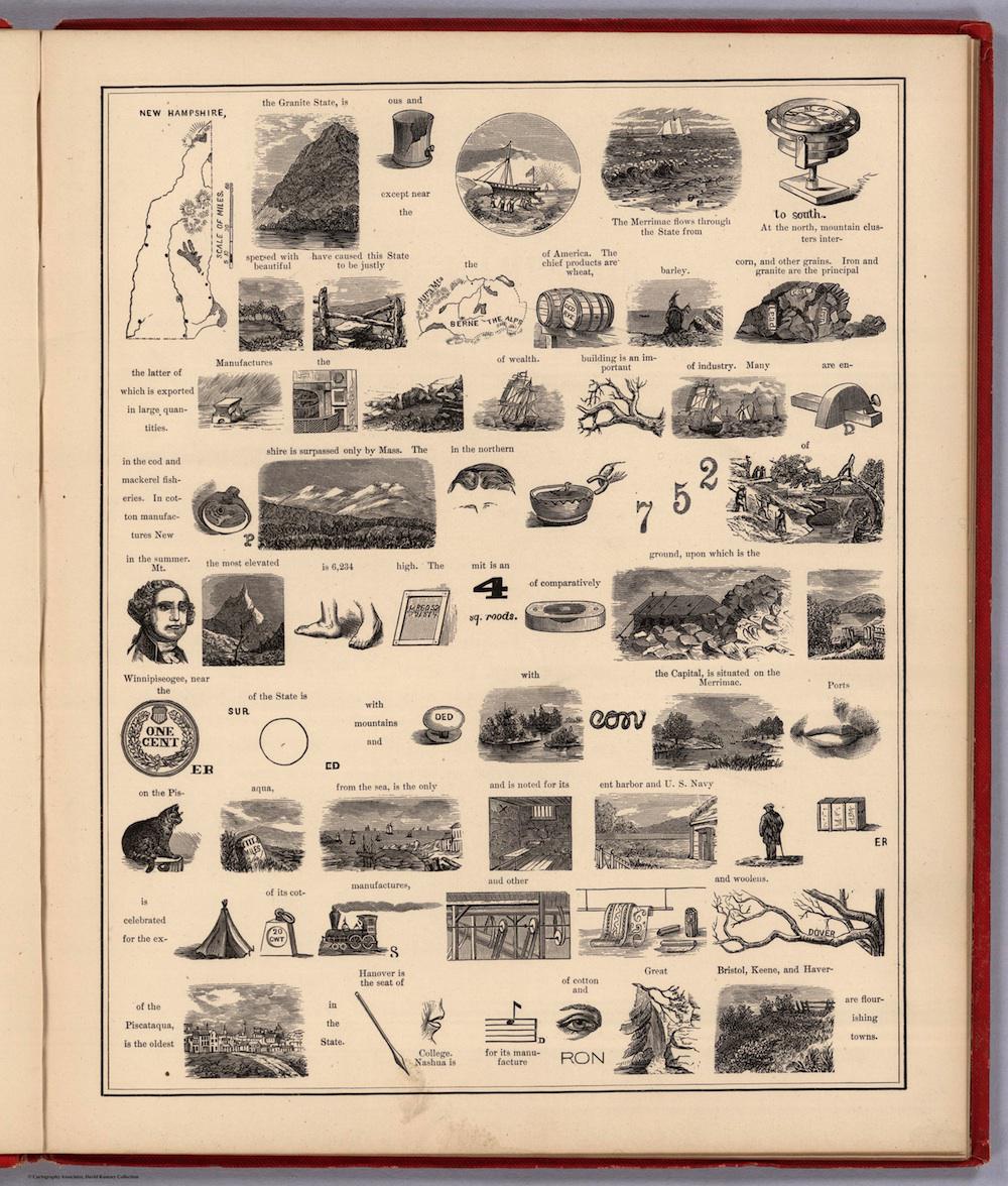
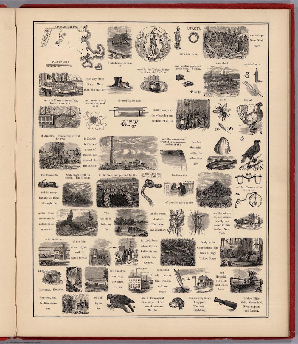
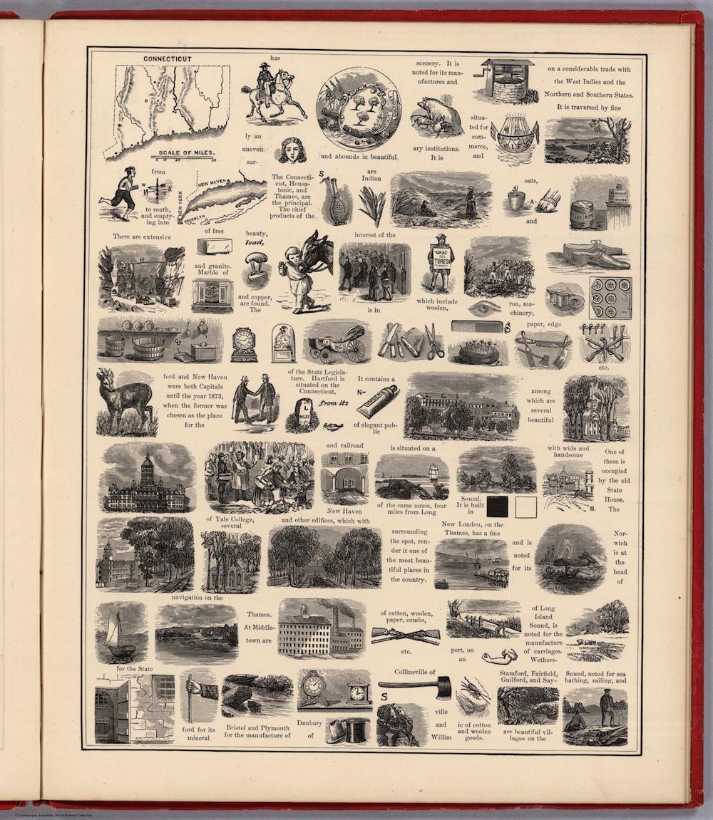
These pages from Anna Heermans’ 1875 project, A Hieroglyphic Geography of the United States, tell little stories about the New England states and New York, in picture form. Published by E.P. Dutton & Co., a company that then specialized in juvenile texts, the pictorial atlas was intended for children’s use—an attempt to bring life to geographical information through imagery.
A rebus (the broad name for this type of writing system) replaces words, or parts of words, with pictures. To take one example, from the New Hampshire page:
Translation: “Mt Washington, the most elevated peak, is 6,234 feet high. The summit is an acre of comparatively level ground, upon which is the Tip Top House.”
In order to figure out the puzzle, the reader must know what Washington looked like; be able to recall that four square roods (an archaic term of measurement) equal an acre; and recognize both the carpenter’s level and the look of the Tip Top House, a small hotel that stood (and still stands) on the summit of Mt. Washington.
While the title page of the Heermans atlas advertises this as the first volume in a series, a 1909 list of atlases in the Library of Congress notes that this remained a one-time effort. In fact, the volume was the only “hieroglyphic geography” of its kind in the Library at the time.
The layout of these pages makes the information hard to understand, with text and pictures misaligned in places. Heermans included a key to a state’s rebus on each following page: the same information written out in text. Readers could decipher the meaning of the hieroglyphs, then see how well they had decoded the information; you can do the same. Here are links to the text pages for Maine, New Hampshire, Massachusetts, and Connecticut.
Click on the images below to zoom, or visit the atlas’ page on the David Rumsey Map Collection’s website.
David Rumsey Map Collection.
David Rumsey Map Collection.
David Rumsey Map Collection.
David Rumsey Map Collection.