The Vault is Slate’s history blog. Like us on Facebook, follow us on Twitter @slatevault, and find us on Tumblr. Find out more about what this space is all about here.
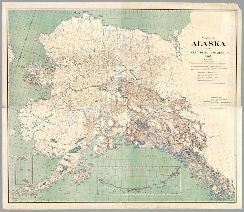
This map of Alaska in 1909 shows all of the transportation and communication infrastructure in the territory at that early date: wagon roads, sled roads, pack trails, railroads, telegraph lines, and even some telephone lines. Wireless stations are noted; the 107-mile wireless radio connection across Norton Sound gets a special mention.
In the nineteenth century, native Alaskans and Russian settlers used the centuries-old tribal network of pack and dog trails. The 1896 discovery of gold in the Klondike turned the attention of American businessmen and developers north. Soon, the government took charge of developing infrastructure in the territory.
The members of the Alaska Road Commission, part of the U.S. War Department, are included underneath the map’s key. The ARC, established in 1905, was responsible for improving all types of trails and roads in Alaska. During the era of this map, the Commission focused on the route from Valdez to Fairbanks, making the rough trail suitable for wagons.
The story of the sled dog teams who brought diphtheria antitoxin to the snowbound town of Nome in 1925 illustrates the rate of road development in Alaska in the intervening 14 years. That year, those teams (one of them famously headed by Balto, who’s since been commemorated in statue and cartoon form) covered nearly a thousand miles between the railroad terminus in Nenana and the sick children in Nome. In 1909, the railroad had yet to reach Nenana, and the route that the dogs took was still just a pack trail.
Click on the image below to reach a zoomable version, or visit the map’s page on the David Rumsey Map Collection website.
David Rumsey Map Collection.