The Vault is Slate’s history blog. Like us on Facebook, follow us on Twitter @slatevault, and find us on Tumblr. Find out more about what this space is all about here.
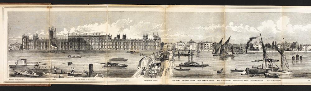
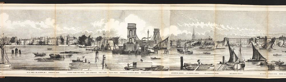
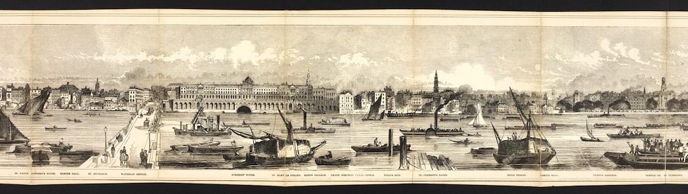
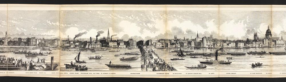
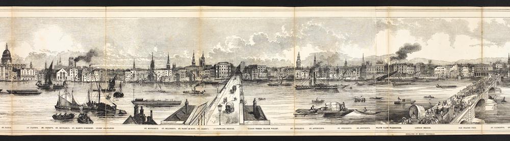
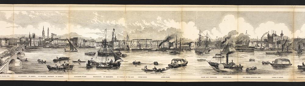
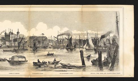
This panorama of the River Thames, engraved by Charles Vizetelly in 1844, was printed in four parts in the London illustrated newspaper Pictorial Weekly. “When readers joined the four parts together, the completed illustration extended to 14 feet in width,” writes the British Library, which has digitized the panorama in seven sections.
The illustration captures ten miles of river, including London landmarks like the Tower of London, Westminster Abbey and the Houses of Parliament, as well as wharfs and warehouses that were sites of commerce and trade. (The Pictorial Weekly captioned the images with proud notes on that commerce: “[The Thames’] bosom bears the ships of all nations, freighted with the richest and rarest products of the earth.”) Tiny carriages and figures traverse the river’s bridges, and boats loaded with all manner of cargo pass by.
The beauty and dignity of the image hides what would have been a smelly reality. As historian Daniel Schneider writes, in the first half of the nineteenth century, the sewage of London flowed to the Thames. Schneider quotes a number of contemporary accounts from harbormasters who described the water as “nearly black at half tide” and “little better than an open sewer.” (I’m leaving the most disgusting of Schneider’s Thames sewage stories behind a hyperlink; click at your own risk!)
After the “Great Stink” of the summer of 1858, Parliament, blighted by the smell wafting in through its windows, mandated the creation of a sewage system and embankments that greatly improved the river’s water quality.
Click on each image to reach a larger, zoomable version, or visit the document’s page on the British Library’s website.
British Library.
British Library.
British Library.
British Library.
British Library.
British Library.
British Library.