The Vault is Slate’s history blog. Like us on Facebook, follow us on Twitter @slatevault, and find us on Tumblr. Find out more about what this space is all about here.
This “Gangland” map of Chicago, published by the firm Bruce-Roberts Inc. in 1931, cloaks itself in moral purpose, trumpeting that it’s “Designed to Inculcate the Most Important Principles of Piety and Virtue in Young Persons and Graphically Portray the Evils and Sin of Large Cities.” Despite that virtuous cover story, the map is pure fun, full of comic-book vernacular, ironic commentary, and references to true crimes of the recent past.
Antiquarian bookseller Elizabeth Burdon writes that the iconic Wonderground Map of the London Underground, created by MacDonald Gill in 1913, influenced map-makers in the United States during the 1920s and 1930s. Burdon calls this type of map a “Wonder Map”: a pictorial production, suffused with whimsy and color, that brings together text and image with a liberal dose of humor. These cartoon “wonder maps” were quick to sell. They weren’t meant to be used for navigation so much as for souvenirs, to be brought home, displayed, and enjoyed.
Chicago’s gang activity during the 1920s and early 1930s was an object of media fascination, receiving copious coverage in national newspapers and and serving as dramatic fodder for many Hollywood scriptwriters. This map seems to have been targeted at fans of these mobster stories, marking spots of famous killings, sites of clashes between police and bootleggers, and the homes and headquarters of notable gangsters.
Click on the image below to reach a zoomable version, or on this link to reach the map’s page in the Newberry Library’s digital collections.
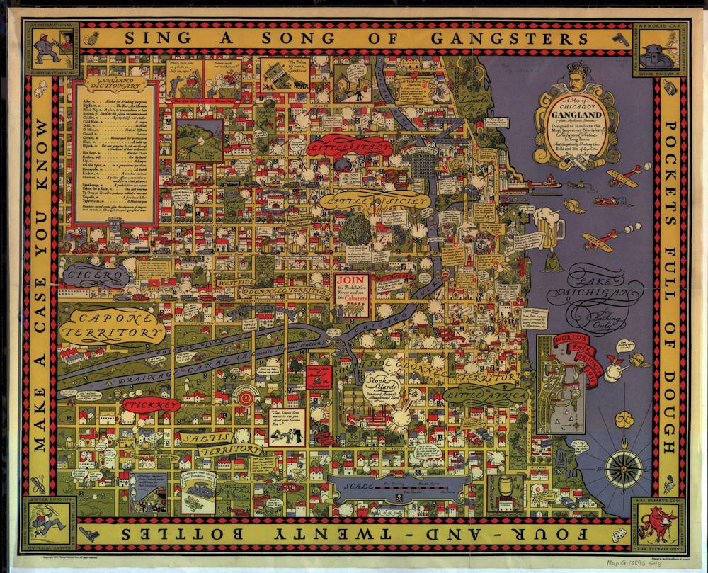
Courtesy of the Newberry Library, Chicago. Map G 10896 .548.