The Vault is Slate’s history blog. Like us on Facebook, follow us on Twitter @slatevault, and find us on Tumblr. Find out more about what this space is all about here.
A group of researchers has collated historical documents to produce an interactive atlas, Pan Inuit Trails, that shows how the Canadian Arctic has long been explored and mapped by the Inuit people.
Inuit groups in Canada have passed down their knowledge of geography through oral tradition. Knowing locations of trails and resources enabled small groups of people to migrate with the animals they hunted and to maintain social connections. The atlas draws from source maps and other descriptions of trails that were recorded during the nineteenth and twentieth centuries, as well as from interviews with elders and community members.
If you visit the atlas page, and turn on the “maps” layer, a set of gray rectangles overlays the map. Hovering over a rectangle with your cursor reveals the name of the map; clicking reveals a downloadable image of the original document, with its metadata.
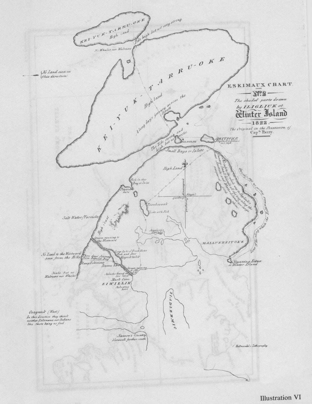
The map below is one of the source documents used to make the atlas. Drawn by Iligliuk, an Inuit woman who collaborated with the explorers of the 1821-23 Sir William Parry expedition, the map shows how the Inuit mentally retained place names, locations of resources, and landmarks. Iligliuk notes locations where many Inuit lived; where one could find asbestos (already valued in Europe in the early nineteenth century) or fish; and places where nobody lived, “there being no food.”
The group that produced the atlas (Michael Bravo of Cambridge’s Scott Polar Research Institute; Claudio Aporta of Dalhousie University; and Fraser Taylor of Carleton University) has a political motivation. In the coming dispute over Arctic sovereignty, the record could serve as proof that the region has been, as Taylor told the Canadian Press, “very much Canadian territory.”