The Vault is Slate’s history blog. Like us on Facebook, follow us on Twitter @slatevault, and find us on Tumblr. Find out more about what this space is all about here.
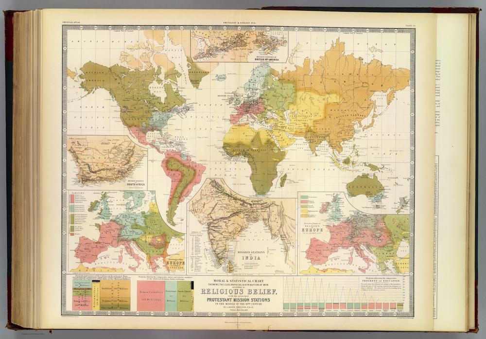
This 1854 map of world religion appeared as part of an atlas published in Scotland by cartographer Alexander Keith Johnston. The map, a “Moral and Statistical Chart Showing the Geographical Distribution of Man According to Religious Belief,” presents religious geography from a Scotch Protestant perspective.
Historian of religion Lincoln Mullen, whose Twitter feed alerted me to this map’s existence, says that religious publications of the time often included figures tallying the relative prevalence of world religions, as a way of encouraging readers to fund and support mission efforts. On this map, the interior of South America, most of Africa, and most of North America are coded green for “pagan”—a signal to Protestants reading the map that these were fertile fields for potential missions.
Mullen points out that the map is “an intriguing combination of optimism and realism” when it comes to assessing the strength of Protestantism. He elaborated over email: “Mission stations in China, for example, are colored as Protestant, but most of Canada is regarded as ‘heathen.’ Places like Manchester, England, show a significant Catholic population”—a realistic reporting of the actual situation.
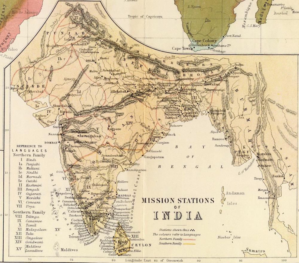
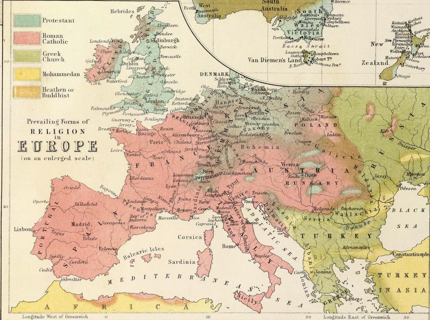
One the most interesting things about this map is the detail of its insets, some of which I’ve blown up and included below. Johnston packs his map with close-ups showing locations of British mission stations in South Africa, India, and Canada.
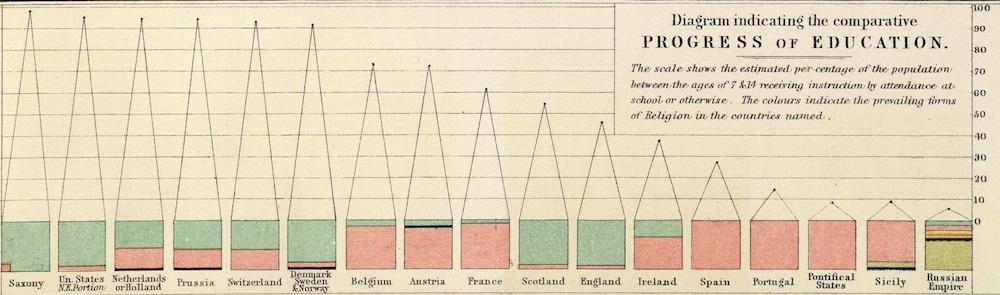
On the bottom right-hand side of the map, Johnston includes a pointed graphic correlating levels of education in populations to religious belief. In his most-educated countries, the blue of Protestantism dominates.
Click on the image below to reach a zoomable version, or visit the map’s page on the David Rumsey Map Collection website.