The Vault is Slate’s history blog. Like us on Facebook, follow us on Twitter @slatevault, and find us on Tumblr. Find out more about what this space is all about here.
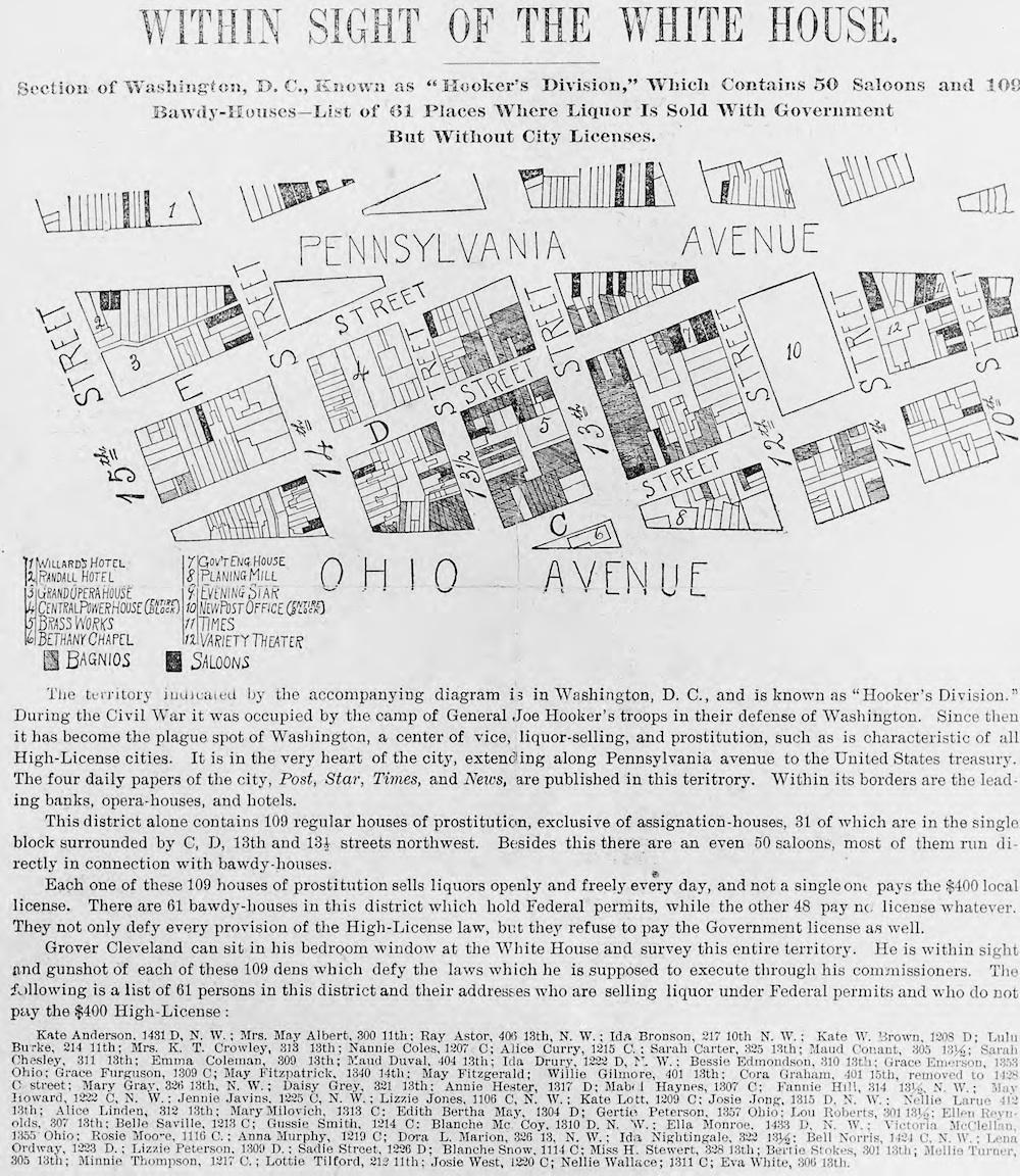
This indignant map exposes the seamy underbelly of 1890s Washington, D.C., naming and locating “saloons” and “bawdy-houses” in the so-called Murder Bay neighborhood, located east of the White House. The Library of Congress, which holds the map, tells us that it’s a newspaper clipping from the 1890s, without a known author or publisher.
The area was the former “Hooker’s Division,” where the Civil War soldiers responsible for the defense of Washington under the command of Gen. Joseph Hooker once sought R&R in their off-duty hours, and its bad reputation persisted decades later.
The unknown mapmaker critiques the efficacy of the so-called “high license” law on the saloons and bordellos of this district. During the late 19th century, advocates of temperance were divided in their support of laws that raised license fees for establishments selling liquor. Some believed that such a scheme would curtail drinking. Others, like the author of this map, thought that “high license” would just encourage sellers to sell illegally, and that nothing short of full prohibition would work.
The mapmaker takes special care to mention legitimate businesses—newspapers, theaters, churches, hotels—around the neighborhood. On the map, each of these has a number, while saloons and “bagnios” (an archaic term for “brothel”) are dark gray and gray, respectively. Through showing the close proximity of these establishments, the author shames those respectable Washingtonians who, like President Grover Cleveland, ignored the presence of sinners in their midst.
Library of Congress.