The Vault is Slate’s history blog. Like us on Facebook, follow us on Twitter @slatevault, and find us on Tumblr. Find out more about what this space is all about here.
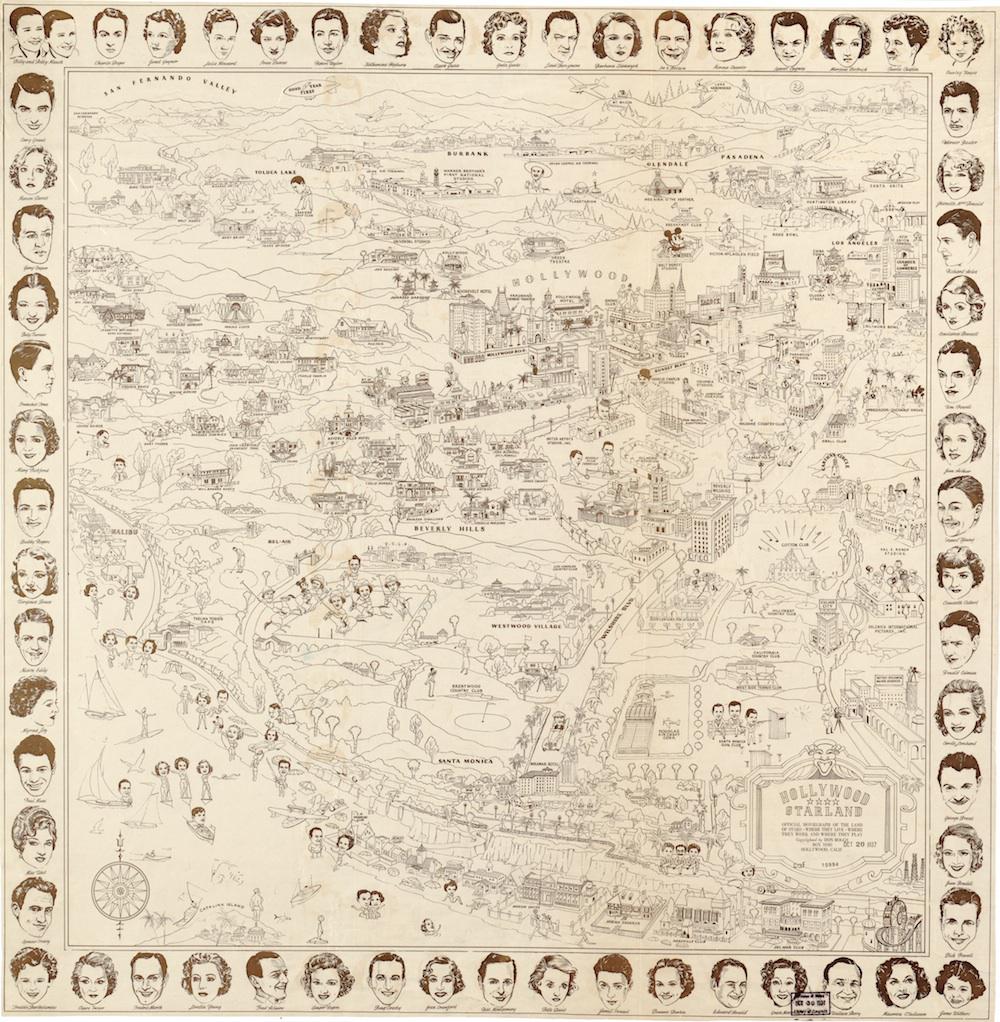
This map of “Hollywood Starland,” which advertised itself as a “moviegraph,” was sold to film-mad fans in the late 1930s. During the Depression, people went to the movies at a startlingly high rate, as the industry adapted to prevailing financial conditions by offering all kinds of cheap rates, sweepstakes, and giveaways. Fan magazines like Photoplay let fans into the lives of the stars, and a map like this one was designed to cater to the desire to know all about where the stars “live, work, and play.”
The faces of favorite actors decorate the border of the map, and the interior is full of little figures playing golf, beach volleyball, polo, and tennis. “Starland,” from the point of view of the fans, looked like an endless round of fun and games.
Viewers poring over the map could try to match the stars’ faces to the cartoons. (For the curious: Big Map Blog put together a list of all of the stars on this map in clockwise order, with links to more information about their careers.)
The map is vague about the locations of stars’ houses, giving only a general sense of their neighborhoods (Marlene Dietrich lived “in Beverly Hills”) and a likeness of their facades, without offering street names. Other maps from the time didn’t skimp on this information, so the choice to remain figurative must have been deliberate. The map may have been intended as a tourists’ souvenir rather than a literal guide to star-stalking.
I first heard about this map through Nathan Masters’ Twitter feed. Click on the image below to reach a larger version, or visit the map’s page on the Library of Congress website.
Library of Congress.