The Vault is Slate’s history blog. Like us on Facebook, follow us on Twitter @slatevault, and find us on Tumblr. Find out more about what this space is all about here.
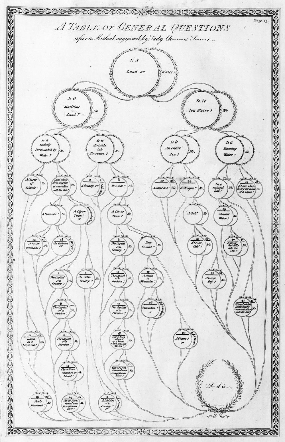
Aloisius Edouard Camille Gaultier, a French Catholic priest working as a tutor in England in the late 18th century, created this chart to aid students in shaping geographical questions. This chart, which is a basic decision tree, shows what kinds of queries should be grouped together (questions about political status, for example, all flow in one “branch”), and offers a simple hierarchy of types of geographical information.
At a time when rote memorization and recitation was central to teaching, Gaultier differentiated himself by doing what we might now call “gamifying” the learning process. He offered several kinds of “instructive games,” as he called them. In one, students would be asked a cascading series of geographical questions, and awarded points based on number of correct answers.
This approach to education was still fundamentally based on memorization (Gaultier’s Familiar Geography, a text published around the same time as this chart, is a mind-numbing list of facts). However, a chart like this shows that teachers began trying new ways of provoking students’ interest long before the innovations of the progressive education movement in the early twentieth century.
I first saw this chart in the newly published Book of Trees: Visualizing Branches of Knowledge, by Manuel Lima. Click on the image to reach a zoomable version.
From Book of Trees: Visualizing Branches of Knowledge, Manuel Lima.