The Vault is Slate’s history blog. Like us on Facebook, follow us on Twitter @slatevault, and find us on Tumblr. Find out more about what this space is all about here.
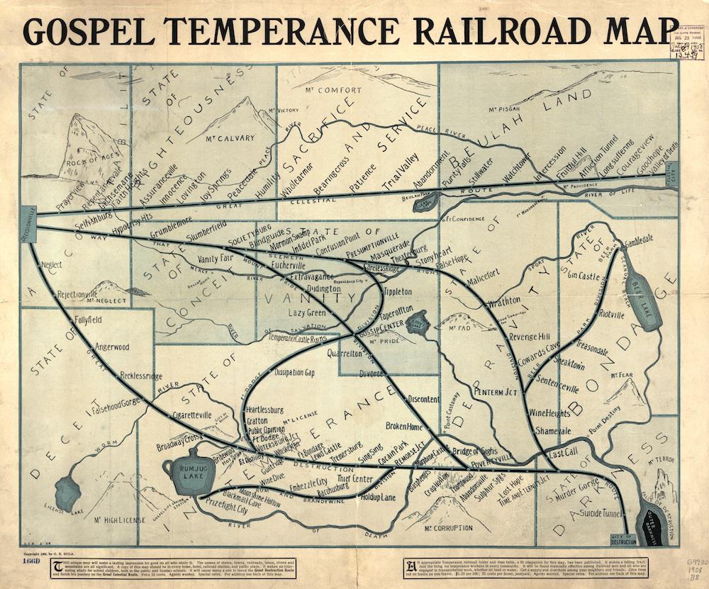
This 1908 map depicts the negative consequences of drinking and ungodliness, using an imaginary set of railroad lines, states, towns, and landmarks. The document was a conversion tool, meant for use by devout people hoping to win others to the path of righteousness.
The reader starts in “Decisionville,” at the left-hand corner of the map, and traverses from left to right. If you take the high road, the straight line from Decisionville to Celestial City, you pass through such sweet-sounding towns as Innocence, Humility, Peacedale, and Patience, while beholding views of Mt. Calvary, Mt. Pisgah and the Rock of Ages. If you take either of the two other lines, you’re in for a tour of such places as Malicefort, Cocain Park, Sing Sing, Dissipation Gap, and Prizefight City.
It appears that “G.E. Bula” may be George E. Bula, an Indianapolis man whose name is listed as president of the Pentecost Bands of the World in the 1910 Statistical Atlas of Christian Missions. (Object of the group: “Spreading the Gospel throughout the world, rescuing famine children in India, and training them for God and a life of usefulness.”)
At the bottom of the map, Bula suggests that outreach workers use this document in conjunction with a railroad folder and timetable, apparently matching the theme of the map. This combination, Bula says, “will be found especially effective among Railroad men and all who are engaged in transportation work, whether on land or water.”
I first saw this map on the Big Map Blog. Click on the image below to enlarge, or visit the map’s page in the Library of Congress’ digital archives.
Library of Congress.