The Vault is Slate’s history blog. Like us on Facebook, follow us on Twitter @slatevault, and find us on Tumblr. Find out more about what this space is all about here.
Englishman Edward Quin’s 1830 atlas, Historical Atlas in a Series of Maps of the World as Known at Different Periods, with an Historical Narrative, featured 21 plates that visually depicted what Quin called “the world as known at different periods.” Dramatic clouds cover the “unknown,” rolling back slowly as time moves on.
The GIF below runs through the plates in sequence, from 2348 B.C., “The Deluge” (Quin, not unusually for his time period, was a Biblical literalist) through A.D. 1828, “End of the General Peace.” You can see static versions of the plates, as well as Quin’s summaries of each period, by looking at the atlas on the David Rumsey Map Collection website.
Quin’s approach to cartography, historian Walter Goffart writes, was far from new, but instead followed an 18th-century trend in atlas-making that tried to present historical change as a unified picture. The use of dark clouds to obscure the unknown areas of the world, however, was Quin’s innovation.
In mapping geographical knowledge through historical time, Quin took the point of view of geographers from the Western tradition. To say that an area of the world was “known” was, for Quin, the same as saying that it was “known” by Greek, Roman, or European cartographers. A set of such maps drawn from the perspective of the Aztecs, Egyptians, or Chinese would, of course, look quite different.
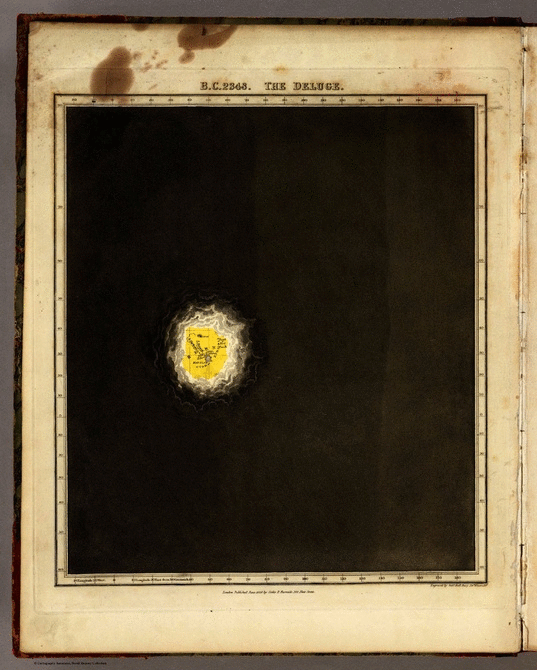
Atlas in a Series of Maps of the World as Known at Different Periods, with an Historical Narrative, 1830
Atlas images via David Rumsey Map Collection