The Vault is Slate’s history blog. Like us on Facebook, follow us on Twitter @slatevault, and find us on Tumblr. Find out more about what this space is all about here.
These beautiful pages come from the Atlas Pintoresco e Historico de los Estados Unidos Mexicanos (Picturesque Historical Atlas of the United States of Mexico), by cartographer Antonio García Cubas. The volume was published in 1885 in Mexico City.
According to historian Raymond B. Craib, while Mexico gained independence from Spain in 1821, throughout the middle of the 19th century Mexican intellectuals and elites worried about establishing Mexico’s image as a coherent and viable nation. To that end, cartographers with the Sociedad Mexicana de Geografía y Estadística (Mexican Society of Geography and Statistics) took up a variety of projects meant to chart the history and present resources of the Mexican state.
While García Cubas had previously published many well-received individual maps and compilations, the 1885 Atlas was particularly notable for its integration of imagery with cartography. Art historian Magali M. Carrera writes that the images in the Atlas pintoresco were meant to offer a visual narrative of Mexico’s progress.
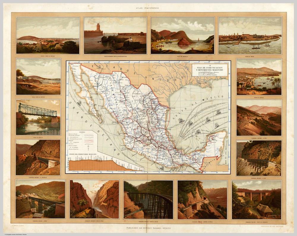
In plates such as “Vias de Comunicacion y Movimiento Maritimo” (“Routes of communication”—in this case apparently including railroads—“and maritime movement”), the García Cubas atlas made an argument to foreign observers: The country has many natural resources and is ready for your investment.
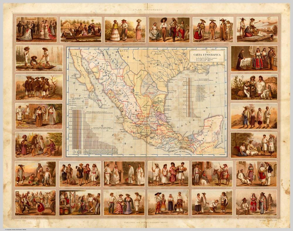
The plate labeled “Carta Etnográfica” (“Ethnographic Chart”) carefully classified the country’s many ethnic groups, depicting them as reassuringly static and comprehensible. The “raza blanca” appears on the top left-hand corner in European-style ball gowns, and everyone else wears picturesque “local” clothing.
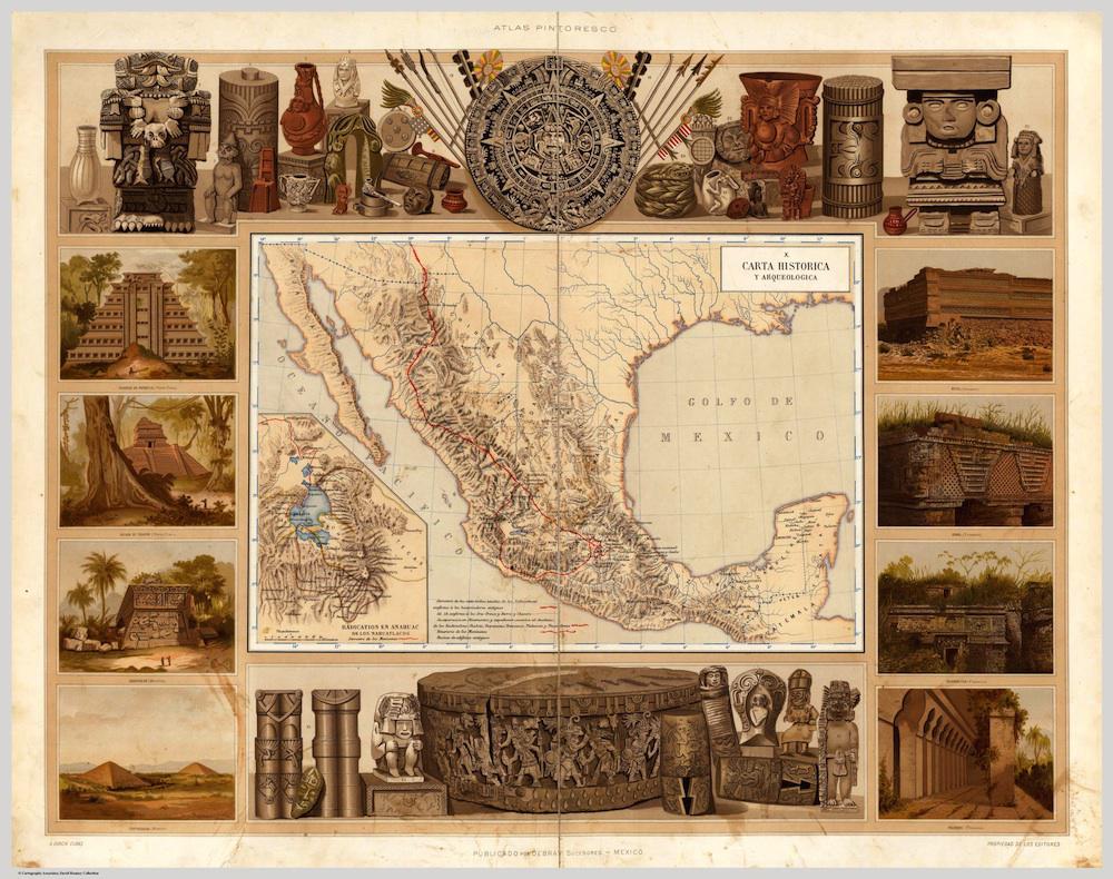
In the “Carta Historica y Arqueológica” (“Historical and Archaeological Chart”), Mexico’s indigenous heritage is offered as another of the country’s many assets.
Click on the images below to arrive at zoomable versions, or visit the atlas’ page on the David Rumsey Map Collection website.
Atlas Pintoresco e Historico de los Estados Unidos Mexicanos, Antonio García Cubas. Via the David Rumsey Map Collection.
Atlas Pintoresco e Historico de los Estados Unidos Mexicanos, Antonio García Cubas. Via the David Rumsey Map Collection.
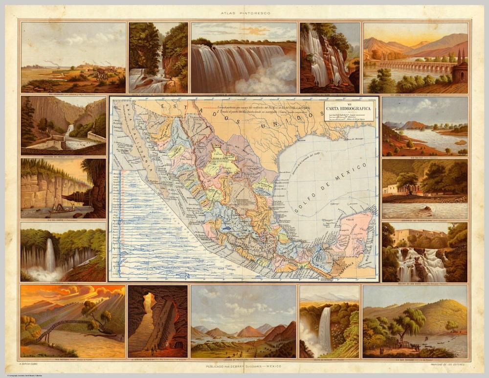
Atlas Pintoresco e Historico de los Estados Unidos Mexicanos, Antonio García Cubas. Via the David Rumsey Map Collection.
Atlas Pintoresco e Historico de los Estados Unidos Mexicanos, Antonio García Cubas. Via the David Rumsey Map Collection.