The Vault is Slate’s history blog. Like us on Facebook, follow us on Twitter @slatevault, and find us on Tumblr. Find out more about what this space is all about here.
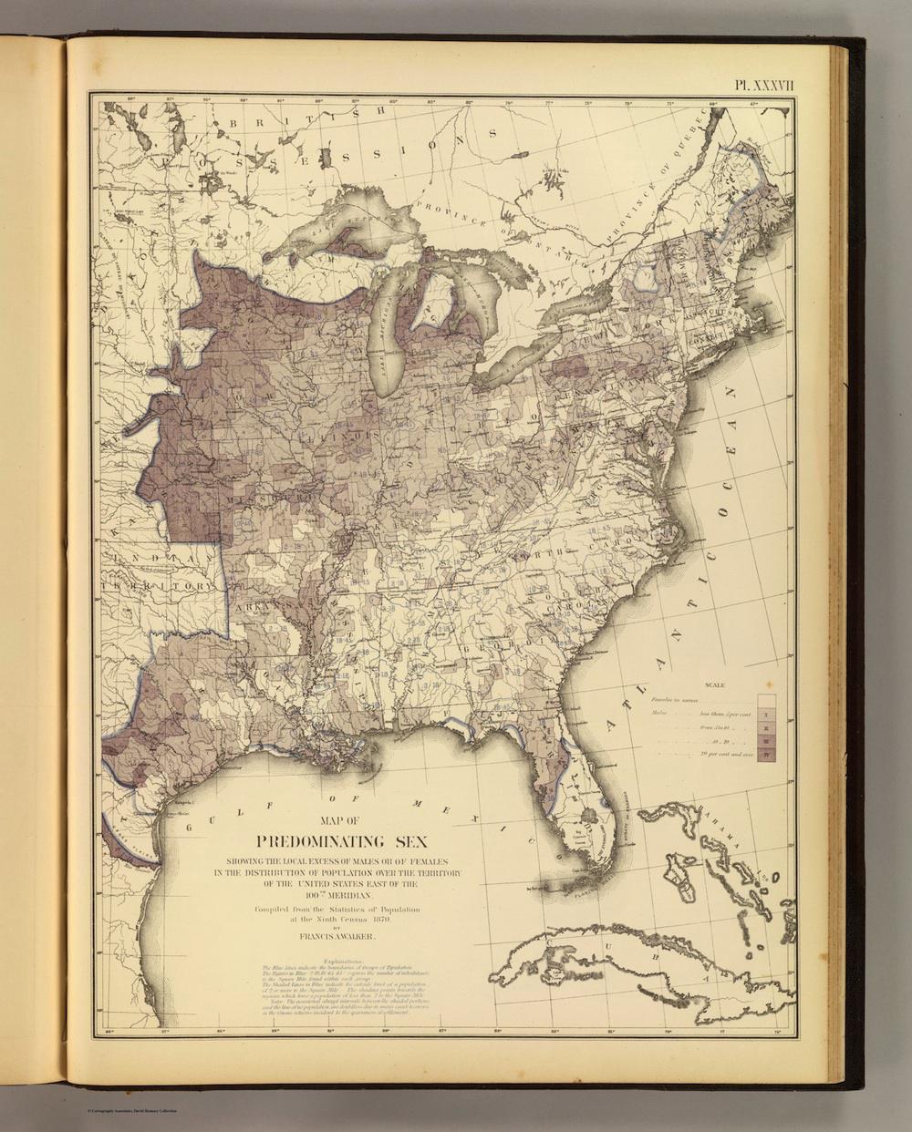
This map comes from Francis Amasa Walker’s 1874 Statistical Atlas of the United States, an early exercise in data visualization which was compiled using findings from the 1870 census. (A few months ago, I shared another map from this atlas, showing the distribution of wealth.)
Because of the mapmaker’s visual choices, the map reads as a representation of maleness. The white areas of the country are where women are to be found “in excess,” and the purple sections show places where males outnumber females. In the darkest-purple areas, the population was more than 20 percent out of balance, with males predominating.
The document is a striking visual record of the femaleness of the Southeast, half a decade after the end of the Civil War. While numbers of enlisted soldiers in the Confederate Army and Civil War casualties (on both sides) are difficult to assess, due to lost and damaged archives, this map shows how the population of the South suffered proportionally more from the loss of men in the war.
The purplest areas are massed around the frontier. In Kansas, Michigan, and Texas, some areas show a more than 20 percent skew toward the male. When pursuing male-dominated frontier jobs, like logging, surveying, and farming, men often moved west alone, marrying or sending for their wives later. In 1870, with westward migration in full swing, the demographic effects on the rest of the country are particularly easy to see.
Click on the map below to arrive at a zoomable version, or visit its page on the David Rumsey Map Collection website.
Click on the map below to arrive at a zoomable version, or visit its page on the David Rumsey Map Collection website.
David Rumsey Map Collection.