The Vault is Slate’s history blog. Like us on Facebook, follow us on Twitter @slatevault, and find us on Tumblr. Find out more about what this space is all about here.
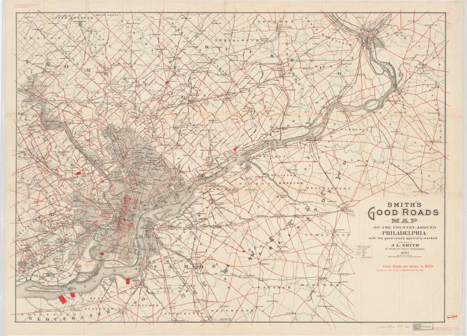
This map outlined in red the “good roads” to be found in and around Philadelphia in 1897. Before standardized, state-funded road maintenance, you might find a potholed, frost-heaved nightmare when you turned your wagon toward your destination. This map was intended to make travel planning easier by giving people a tool to investigate conditions before they set out.
The title of the map—“Good Roads Map of the Country Around Philadelphia”—capitalized on a concept much in the zeitgeist at the time. Beginning in the early 1890s, before automobiles were widely available, a national Good Roads Movement began to call for public investment in road maintenance. “Good Roads” activists argued that a modern nation needed modern infrastructure, so that farmers could get goods to market and travelers could make connections between distant cities.
The Good Roads movement held conventions, published a national magazine and a Year Book, and mounted an exhibit at the 1893 Chicago World’s Fair. The increased popularity of the bicycle in the 1890s meant that cyclists were natural additions to the movement. Railways joined in the effort, seeing that it would be to their economic benefit if transportation to and from stations improved. And state-level Good Roads Associations multiplied as the automobile became more popular, keeping track of appropriations made for road maintenance and the staffing of state highway departments.
Although the institution of state and federal transportation bureaucracy largely shifted attention from the movement in midcentury, some legacy Good Roads associations do still exist.
Click on the image to arrive at a zoomable version, or visit the map’s page on the Harvard University Library’s digital collections website.
Courtesy of the Harvard University Library’s Harvard Map Collection.