The Vault is Slate’s history blog. Like us on Facebook, follow us on Twitter @slatevault, and find us on Tumblr. Find out more about what this space is all about here.
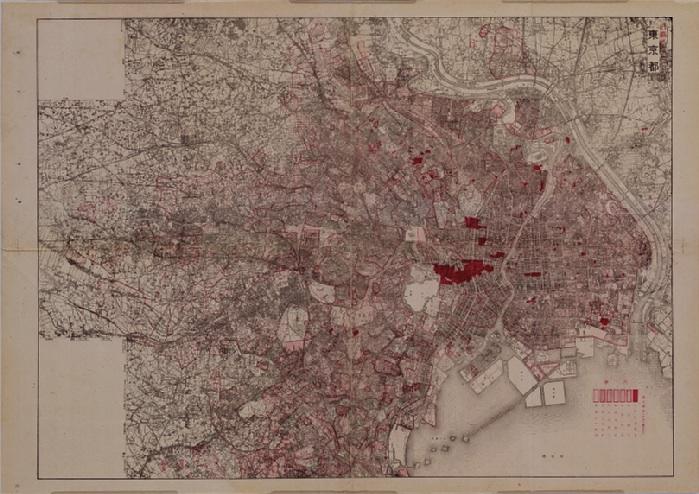
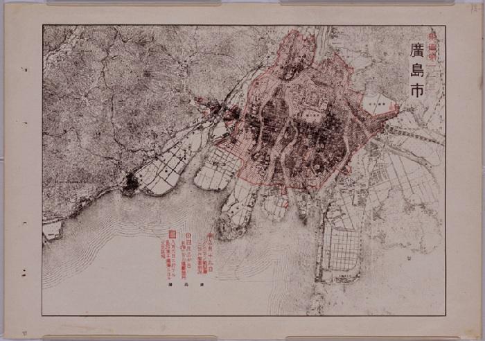
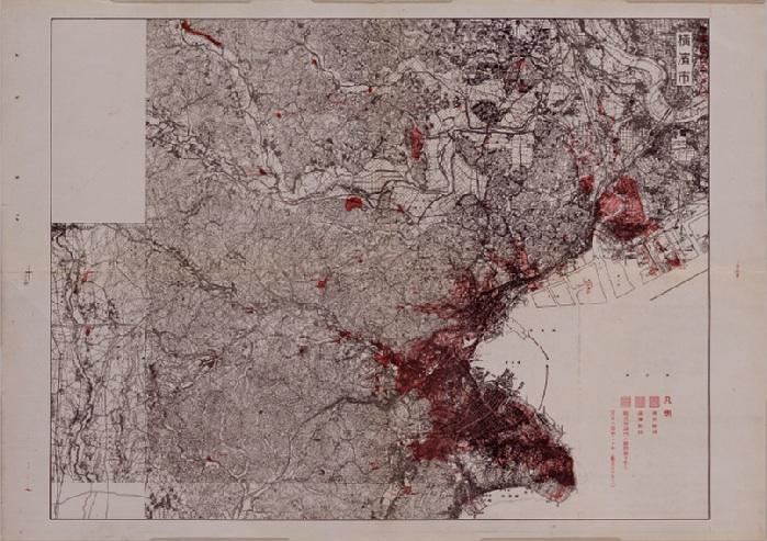
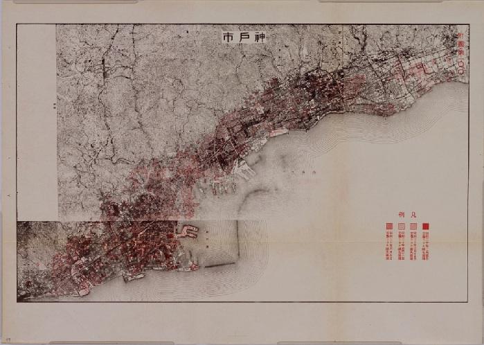
These maps of Japanese cities were published in December 1945 by the Records Department of Japan’s First Demobilization Ministry. The National Archives of Japan, which hosts a digital collection of the 138 air-raid damage maps, writes that the documents were meant to inform soldiers returning from service in the recently ended war about the status of their homes: “The first question asked by repatriating military personnel and civilian employees of the military landing on Japanese shores was generally about air-raid damage.” Often, the maps were displayed on troop transport ships.
The different hatchings and shadings of red on these maps indicate areas affected by separate strikes. On the Tokyo map, writes journalist Daisuke Shimizu of the Japanese newspaper Asahi Shimbun, seven different red areas correspond to seven days of bombing in the spring of 1945. One of these outlines the damage of the Great Tokyo Air Raid of March 9–10, 1945, in which 100,000 people died.
World War II was a major turning point in conventional wisdom about the ethics of bombing civilian targets. As historian John Dower writes, when Japan bombed Chinese cities in 1937, there was public outrage in the United States, and the State Department issued a statement of condemnation. British and American officials denounced German bombings of British and Polish cities early in the war as “inhuman.”
But by 1942, with Allied bombings of Hamburg, Germany, the Allies had changed their policy. Despite some internal objections to the practice, British and American air forces bombed civilian targets in the German cities of Hamburg, Dresden, and Berlin from 1942-1945. The bombing campaign against Japan eventually hit 66 cities—including the famous strikes on Hiroshima and Nagasaki—and, as Dower writes, may have killed 400,000 people.
To reach zoomable versions of these maps, click on the images below, then follow the “Full Color Images” link to arrive at the National Archives’ zoom feature.
National Archives of Japan
National Archives of Japan
National Archives of Japan
National Archives of Japan
See more of Slate’s maps.