The Vault is Slate’s history blog. Like us on Facebook, follow us on Twitter @slatevault, and find us on Tumblr. Find out more about what this space is all about here.
These maps are distorted visions of the U.S., meant to reflect the distribution of total population and of people living in urban areas, as recorded in the 1930 census.
The first map (seen here in zoomable format) sizes states according to total population and colors cities with more than 50,000 residents a bright kelly green. The second sizes states in proportion to the number of residents who reported living in an urban area.
The maps show how Americans clustered in the north and the east, even after the storied westward expansion of the 19th century. New York and New Jersey bulge into the ocean, while Illinois, Wisconsin, and Michigan take up their share of real estate. Depicted before its wartime and postwar population boom, California appears surprisingly small, and the Mountain West and the Sun Belt barely register.
The maps were originally meant to help advertisers and businesses target their efforts. The publishers of Printer’s Ink, a New York journal catering to marketers and advertisers, commissioned the first, while the Dartnell Corporation, a Chicago firm that published handbooks and training advice for sales and marketing departments, produced the second.
I first saw these images in a post on the Making Maps blog, which features several other historic cartograms (maps in which areas are blown up or reduced according to a variable other than their real-life measurements) from the 1920s and 1930s. The horsepower maps, which show electrical capacity installed in each state and basically mirror these population maps, also merit a look.
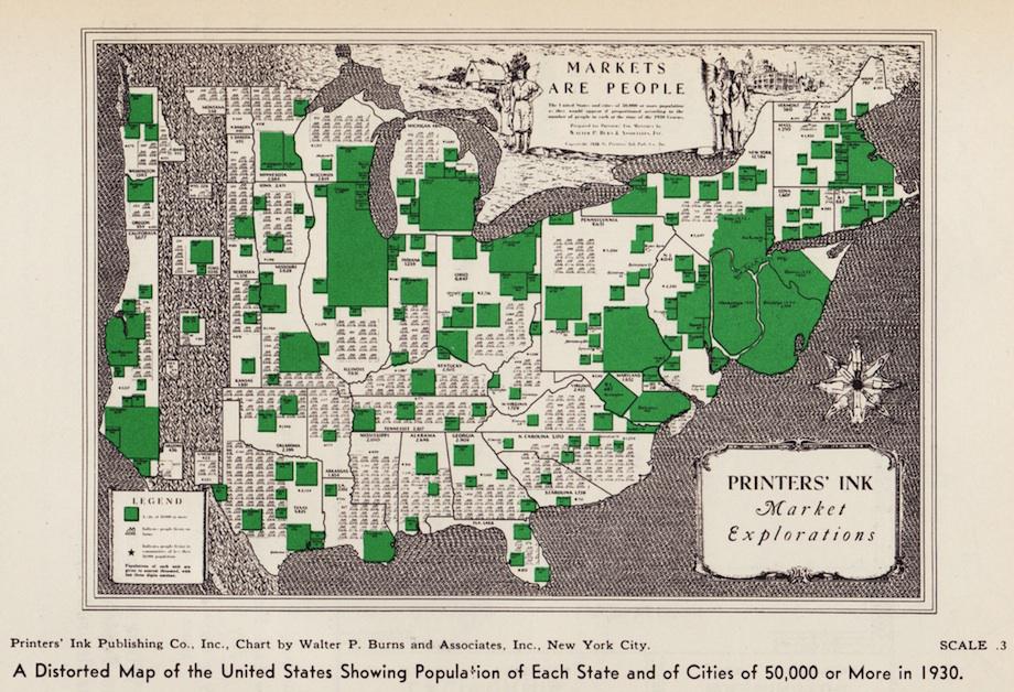
“A Distorted Map of the United States Showing Population of Each State and of Cities of 50,000 or More in 1930.” Printers’ Ink Publishing Co., Inc. Chart by Walter P. Burns and Associates, Inc., NYC. Image courtesy of Making Maps.
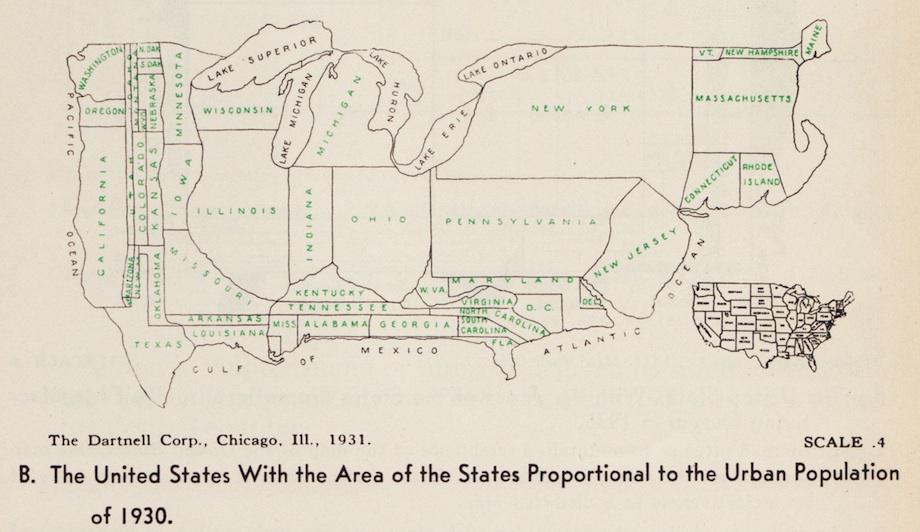
“The United States With the Area of the States Proportional to the Urban Population of 1930.” The Dartnell Corporation, Chicago, Ill., 1931. Image courtesy of Making Maps.