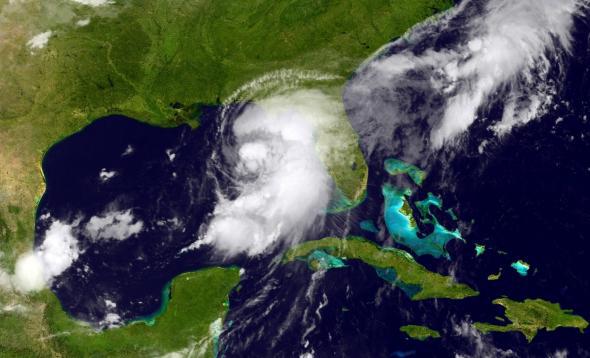
It’s hurricane season and you know what that means: CNN correspondents are dusting off their raincoats in anticipation of standing brazenly on America’s soon-to-be-battered coastlines. The latest anthropomorphized menace is Hurricane Hermine, which has been gaining strength and is expected to make landfall in Florida late Thursday night. When it arrives, Hermine will be the first hurricane to reach shore in Florida since 2005.
At the moment, Hermine is a category 1 hurricane (the lowest of the 5 categories) meaning it has winds around 75 mph; it’s currently churning northeast through the Gulf of Mexico where it is expected to cut across Florida to the east of the state’s panhandle and up the Eastern seaboard. The storm is considered life threatening and Florida state officials are taking the threat seriously. Along with high winds, a deluge of 10-15 inches of rain are expected in some areas; flooding and tornados are also a worry.
Florida Gov. Rick Scott declared a state of emergency in 51 of the state’s 67 counties. Farther north, the governors of Georgia and North Carolina has both issued state of emergencies for dozens of counties in anticipation of large amounts of rain. Tropical storm watches are in effect as far north as New Jersey.