Helicopter pilot and photojournalist Bruce Haffner snagged this incredible photo of a microburst over Phoenix on Monday. Yes, this is a real picture, not a nuclear blast Photoshopped over the city.
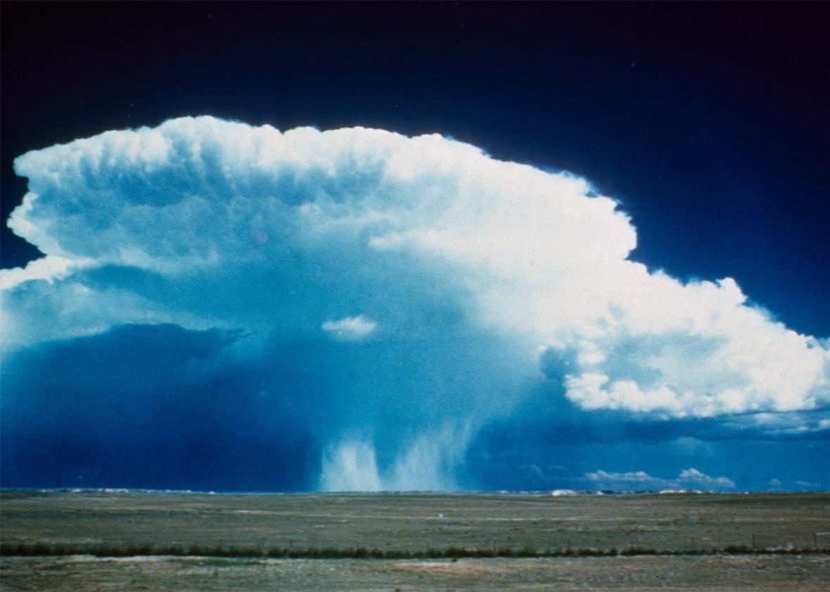
A microburst is basically a tornado in reverse, according to descriptions by the Weather Channel. They have two important similarities: They both generate destructive winds, and they make for indisputably great photos. But while a tornado funnels wind in and up, a microburst’s wind is funneled down and out. And though tornadoes are formed when warm air gets pulled up into thunderclouds, microbursts are the result of cool air that rapidly descends from the thundercloud.
As noted in a weather blog by Georgia news station WRDW, microbursts happen more in the summer, when weather becomes more volatile and unpredictable due to humidity and heat, which is what produces the thunderclouds and thunderstorms.
Less common than tornadoes, microbursts are a little shorter in duration and a slightly less dangerous in speed. Still, they’re not just photo opportuties—several plane crashes have been attributed to microbursts near runways during landing or takeoff. And high speed winds of up to 168 miles per hour can cause damage to human and buildings.
The picture appears to be a wet microburst, meaning it contains rain or mist. Although this type is most common in the Southeast, wet microbursts play an important role during Arizona’s monsoon season—which occurs each year between June 15 and Sept. 30—contributing significantly to the state’s scant levels of precipitation.
As you might guess from the name “wet” microbursts, there are also dry microbursts, in which the water evaporates before reaching the ground. Dry microbursts are largely invisible because a lack of water means a lack of visible clouds (though the wind can still be extreme). They’re also responsible for heat bursts, fascinating events where temperatures can rise 20 degrees over a large area in just a few minutes.
There’s almost no way to accurately predict a microburst, but in general, meterologists look for favorable conditions: hot, humid summer afternoons with strong winds and large amounts of “precipitable water” in the lower atmosphere, according to WRDW. They’re more likely to occur when and where thunderstorm watches have been issued.
Because of the wind danger, it’s best to take cover in a basement or windowless room during a microburst.