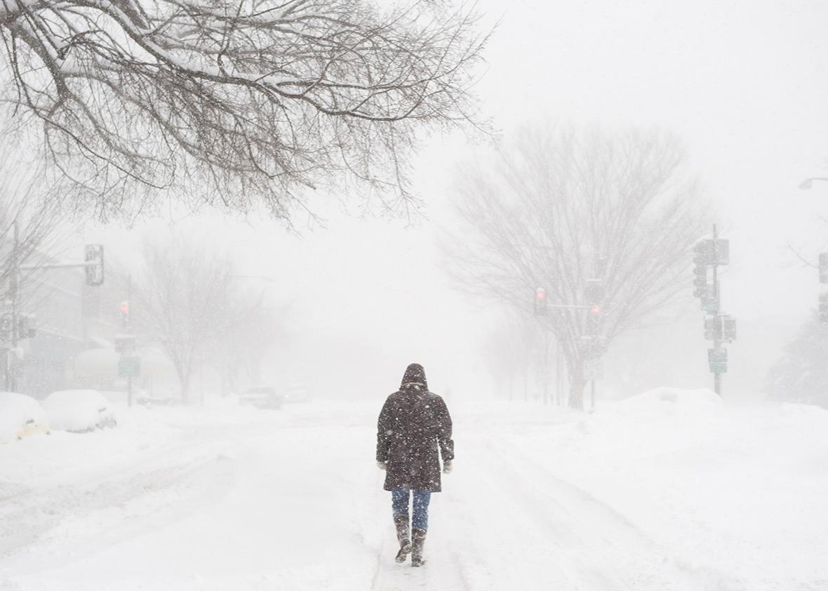
Yesterday, we asked you to send us your most pressing questions about the blizzard set to hit the east coast. And, man, did you ever. Here are my answers:
What effect does the Hudson River play, if any, on things like snow accumulation? I’m in NJ, only about 15 miles from NYC and it seems that we get significantly more snow than, say, Central Park.
This is a pretty great question. Quite often, during snowstorms, NYC will be just one or two degrees warmer than across the Hudson in New Jersey—mostly since NYC is a bit closer to the ocean, which is always above freezing. It has nothing to do with the river itself, but sometimes that little bit of cooler air will greatly boost snow totals and mean the difference between a fluffy white blanket in your backyard versus gross brown slush.
Uh, “Jonas” was [named] by The Weather Channel and has no official status, is that right?
Correct. The Weather Channel does pretty good work, even though they get a bad rap from weather nerds. But I agree that their winter storm naming is a shameless attempt at marketing themselves and, you’re right, it has no official status.
On behalf of all teachers in NYC, is it at all possible that the storm could change its timeline so that we get a snow day on Friday or Monday?
Ehhhhhhh, that’s going to be a tough one. For DC, sure. I’m guessing Wednesday night’s #snowlock after just an inch or two of accumulation guarantees a Friday snow day for everyone there. But since this storm is going to take its sweet time moving up the coast, the worst of it won’t reach NYC until Saturday, and then wrap up by Sunday morning. If the worst case materializes and New York City winds up with two feet of snow, then *ping!* you’ve just earned a day off on Monday. But that’s very doubtful.
What are your thoughts on NYC’s snowfall forecast?
New York City is definitely the major wildcard in this storm right now. And, from the looks of it—there’s a sharp northern cutoff for snowfall in the weather models—its forecast is going to go right down to the wire. The best I can do right now is offer a wide range of possibilities—from six inches (if the storm stays a bit further south) all the way up to two feet (if the storm goes a bit further north). The difference we’re talking about is only 50 miles, so it’s incredibly tough to pinpoint at the moment.
DC snow: Are all the weather models still saying the same thing about this storm? When do you become confident in estimating snowfall amounts?
To answer in order: Yes, and for this storm, right now. DC is going to get absolutely walloped. Partly because of the semi-stable current configuration of the jet stream in the Pacific Ocean, weather models have been able to lock on to this storm’s potential exceptionally early this time around. That said, the ultimate amount of snow on the fringes of the storm, like in NYC, is still somewhat up for grabs, as I explained above.
So, it’s clear that DC is getting slammed with snow… my pressing question is: Based on the amounts predicted and the timing, which seems to be switching a lot, do I really need to wear my snow boots on Friday so I can trudge home after abandoning my car on a packed highway, or do you think [my office] will just call it a snow day so there’s a chance I might actually get home after work on Friday in less than 5 hours?
If your office is paying attention, they’ll call Friday a snow day, so bunny slippers it is.
I am meeting up with an old friend in Connecticut for the weekend. I haven’t seen her in ages, and we’ve had this get together on the books for months. The trip consists of me using the train from NYC on Friday, and returning Sunday. Should I chance my luck and go, or is staying home and sipping wine a better bet?
You should go ahead and go. North of NYC, the snow will be drastically less than south of NYC, so it should be just an average winter day in Connecticut—though you might have trouble getting back into the city on Sunday.
I live in Charlotte, NC, and the consensus of the various forecasts points to a melange of rain, freezing rain, ice pellets, and snow. However, each forecast (local ABC, Weather.com, Wunderground, NOAA, local CBS) has varying precipitation estimates, timing, and length of storm event. Why are their models so different?
Like NYC, Charlotte is just on the edge of this storm, so that’s why the forecast is changing so much right now. However, it’s seeming more and more likely that there’ll be a big ice storm in Charlotte on Friday.
As someone already reeling from the recent news that the L train in NYC may have to shut down for 3 (!) years to fix the flooding from Sandy, I’m wondering about something mentioned in your article “Blizzard Storm Surge Could Rival An East Coast Hurricane Landfall.” You state that human-caused climate change could add another foot to this week’s storm surge, which could be enough to flood the subways again. Is climate change already adding 12-plus inches to storm surges? Is that the new normal?
Yes, climate change is already adding 12-plus inches to storm surges in the Northeast. Especially for big storms like this one, that could be the difference between flooding and not flooding critical infrastructure. Thankfully, New York City itself will have minimal flooding issues from this storm, if any, and during the day on Thursday the weather models have been trending down for coastal flooding elsewhere, too. Still, to be on the safe side, people in southern New Jersey, Delaware, and Maryland should prepare for major flooding.
Thundersnow: Ok, my question isn’t really about thundersnow, but I was hoping it would get your attention, since meteorologists seem to love thundersnow. My real question: I saw an estimation that this storm might hold the equivalent of almost 3 inches of water (which meteorologists then translate to 10-15 inches of snow per inch). How do you guesstimate how much water is in a storm?
Your trick worked! And, this is a very important question. Snow fluffiness (how much snow an inch of water can make) depends greatly on the shape of the snowflake, which depends greatly on the temperature not only at the surface, but throughout the entire storm at different levels of the atmosphere. (That’s seriously a great link, you should click it.) Snow-to-liquid ratios max out with really cold air, but not too cold—about 5 degrees Fahrenheit—and quickly drop off to 1-to-1 as temperatures rise from around 30 degrees to above freezing, which makes sense. Weather models estimate the amount of water in the storm based on a combination of the humidity levels at various altitudes within the clouds as well as how fast the air is rising and converting that humidity into actual precipitation. It takes a supercomputer to do all this, and we’re still not very good at it.
Will it take Manhattan? My pregnant wife is due any day now, and a drive to the hospital in NYC in a blizzard is not part of the plan. Should we make other arrangements? Or is this storm going to only brush by Manhattan while punishing DC and Philly like the “Snowmaggedon” storm of 2010?
Mazel tov! My friend and fellow weather reporter at Mashable, Andrew Freedman, had this exact same scenario happen this time last year. His decision was to get a hotel room across the street from the hospital. Worst case scenario, you’re out some money and can relax—just the two of you—before the baby comes.
Should I panic more about Jonas, the stock market, or Trump?
How gross is snowmelt? Hypothetically, let’s say this storm is so catastrophic that I can’t get delivery food. (I live in Brooklyn, so that counts as a serious cataclysm.) Let’s further say that for some reason I’m not clear on, the water shuts off too. Can I melt snow and drink it? Obviously I’m talking top-layer, white, fresh snow.
Yep, the top-layer stuff will definitely keep you alive, though good luck finding any that won’t be savagely defended by other survivalists thinking along the same lines as you.
Will this storm bring good snow for packing into snowballs and building snowmen? What are the factors that make a difference in the type of snow?
It will absolutely be good snowman snow, especially in NYC. How can I tell? Good snowman snow has a bit of moisture in it, which means the temperature when it fell was close to the freezing point (see above). Plus, temperatures in the 30s and low 40s on Sunday and Monday means it will melt a bit, sure, but just enhance the snowmanability factor even more.
Could this storm be a total bust? Are there any indications from any models that the storm may draw in more (relatively) milder air from the Atlantic than expected and make this more of a cold rain event for DC?
As I said above, it might not be huge in NYC. But as things look right now, it’s almost impossible to imagine that DC will avoid at least 12-18 inches of snow from this sucker.