This weekend, a stunning transformation took place over the north Pacific Ocean.
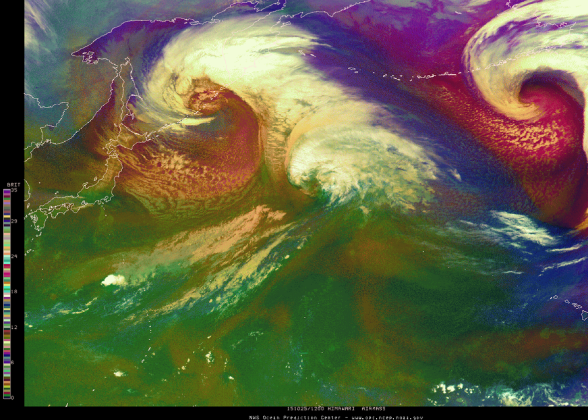
What you are seeing above is a textbook case of bombogenesis, a technical meteorological term for when a storm “bombs” out, deepening at a rate faster than 24 millibars in 24 hours, which occasionally happens as storms move from the tropics through the midlatitudes.
Over the tropics, cyclones get much of their energy from warm ocean waters. Over the midlatitudes, they grow stronger by taking advantage of the differences in temperature in the transition zone when colder air from the poles meets warmer air from the tropics. When a storm shifts between these two energy sources, it’s called extratropical transition, and in extreme cases, produces very photogenic comma-shaped cloud systems.
Even more stunning, in this case it happened to two storms at exactly the same time. Watch:
The storm on the left is fed by the remnants of Typhoon Champi, the storm on the right by the remnants of Hurricane Olaf. Both storms have spent their entire lifespans over the open ocean, which is much warmer than average due to a combination of the near-record strength El Niño and long term climate warming.
Even more impressive is this sort of crystal-smooth satellite animation wasn’t possible even just a few months ago. Japan’s new Himawari-8 weather satellite, which provided the view, is the most advanced, highest resolution weather satellite ever created, and it’s provided meteorologists a magnificent opportunity to better study these types of storms.