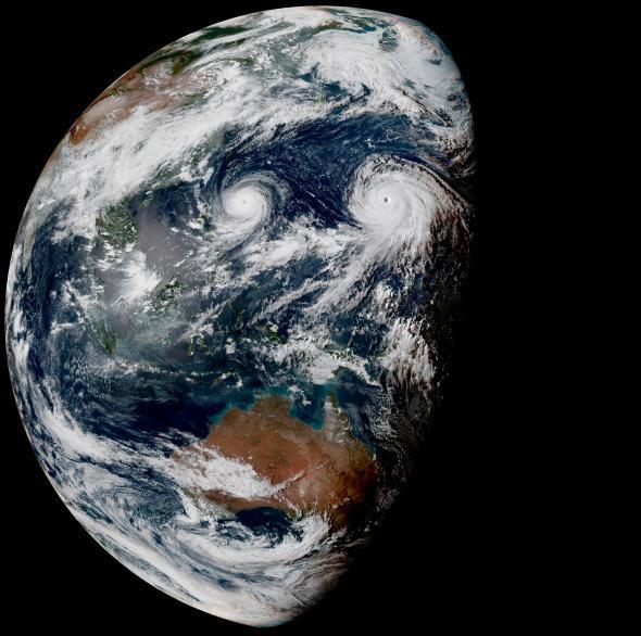
Wow. That’s Earth, as seen on Wednesday from Japan’s glorious new weather satellite, the Himawari-8. You owe it to yourself to click and explore the above image, because wow.
The Himawari-8, hovering 22,000 miles above the Pacific, takes these images every 10 minutes (compared with once every three hours for the U.S. weather satellites, at half the resolution), which allows for exceptionally smooth animations. For example, here’s the last 10 hours:
The twin typhoons—Goni on the left and Atsani on the right—may become the first simultaneous supertyphoons since October 1997. That was, not coincidentally, the last time there was a strong El Niño, before the one we are in now. Goni may threaten the Philippines, Taiwan, and/or Japan over the next several days, but Atsani should remain safely out at sea.
In general, El Niño gives a boost to typhoon formation in the central Pacific. And overall, the Northern Hemisphere has seen a record number of especially strong storms so far this year. That’s led to a feedback loop of sorts, which has helped to boost the strength of El Niño itself.
At full resolution (5,500 by 5,500 pixels), the GIF of Himawari-8 images above would probably weigh in at more than half a gigabyte. You’re free to build something like that yourself, if you dare, via the recent Himawari-8 data archive, here.