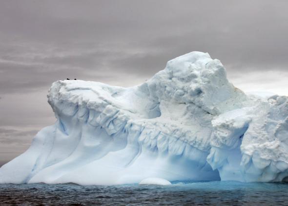
When climate change conversations center on glacier melt and sea level rise, many people immediately think about polar bears helplessly swimming the Arctic Ocean. But Antarctica has glaciers, too, and they’re also melting. In fact, the melt rate in West Antarctica’s most vulnerable region, the Amundsen Sea Embayment, has tripled over the last decade, according to new research released on Tuesday.
The total glacier loss averaged 91.5 billion tons per year according to the study, which means that every two years for the last two decades it lost a water weight equivalent to Mt. Everest. The loss rate has only been getting worse, accelerating by an average of 6.7 billion tons per year since 1992.
The Amundsen Sea Embayment is Antarctica’s biggest contributor to sea level rise. This study, done jointly by scientists from the University of California–Irvine and NASA, is the first to provide an authoritative estimate of how much of the glacier has been lost and how the rate of loss has changed over the last two decades. They used results from four different measurement techniques, with data spanning from 1992 to 2013, to produce the paper, which has been accepted for publication in the journal Geophysical Research Letters.
From the press release making the announcement:
Lead author Tyler Sutterley, a doctoral candidate at UCI, and his team did the analysis to verify that the melting in this part of Antarctica is shifting into high gear. “Previous studies had suggested that this region is starting to change very dramatically since the 1990s, and we wanted to see how all the different techniques compared,” Sutterley said. “The remarkable agreement among the techniques gave us confidence that we are getting this right.”
The researchers worked with mass balance measurements, which indicate how much ice the glaciers gained and lost over time.
The four data sets included two from NASA—one set of satellite data and one from laser altimetry. The other two observation sets were from radar altimetry from the European Space Agency’s Envisat satellite, and “mass budget analyses using radars and the University of Utrecht’s Regional Atmospheric Climate model.”
Sea level rise is one of climate change’s biggest threats, and glacier and ice sheet behavior are two of the biggest uncertainties in predicting future sea level, according to the release. “We have an excellent observing network now,” said coauthor Isabella Velicogna. “It’s critical that we maintain this network to continue monitoring the changes, because the changes are proceeding very fast.”