Serbia-born, Paris-based architect Jug Cerovic moonlights as a map designer who has created a series of standardized subway maps of cities around the world.
Screenshot courtesy of Jug Cerovic
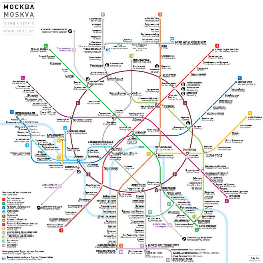
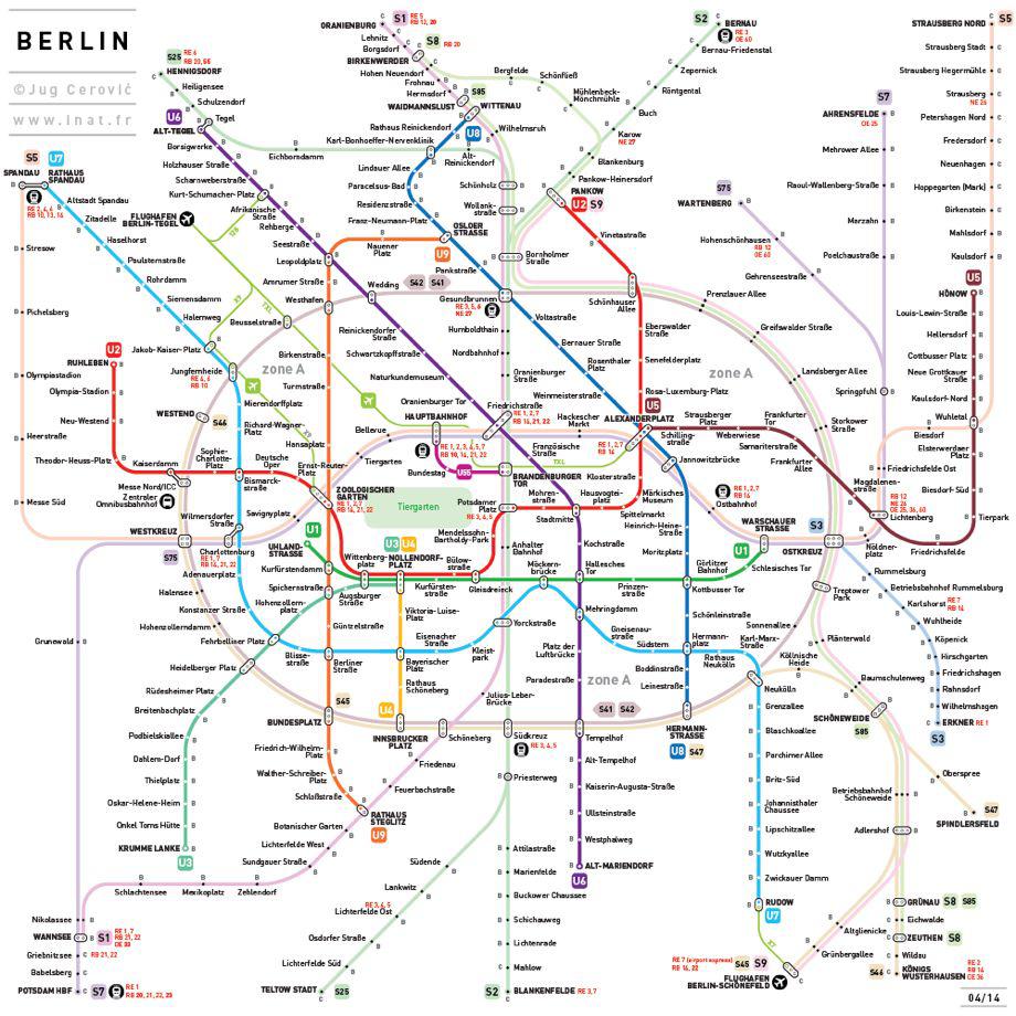
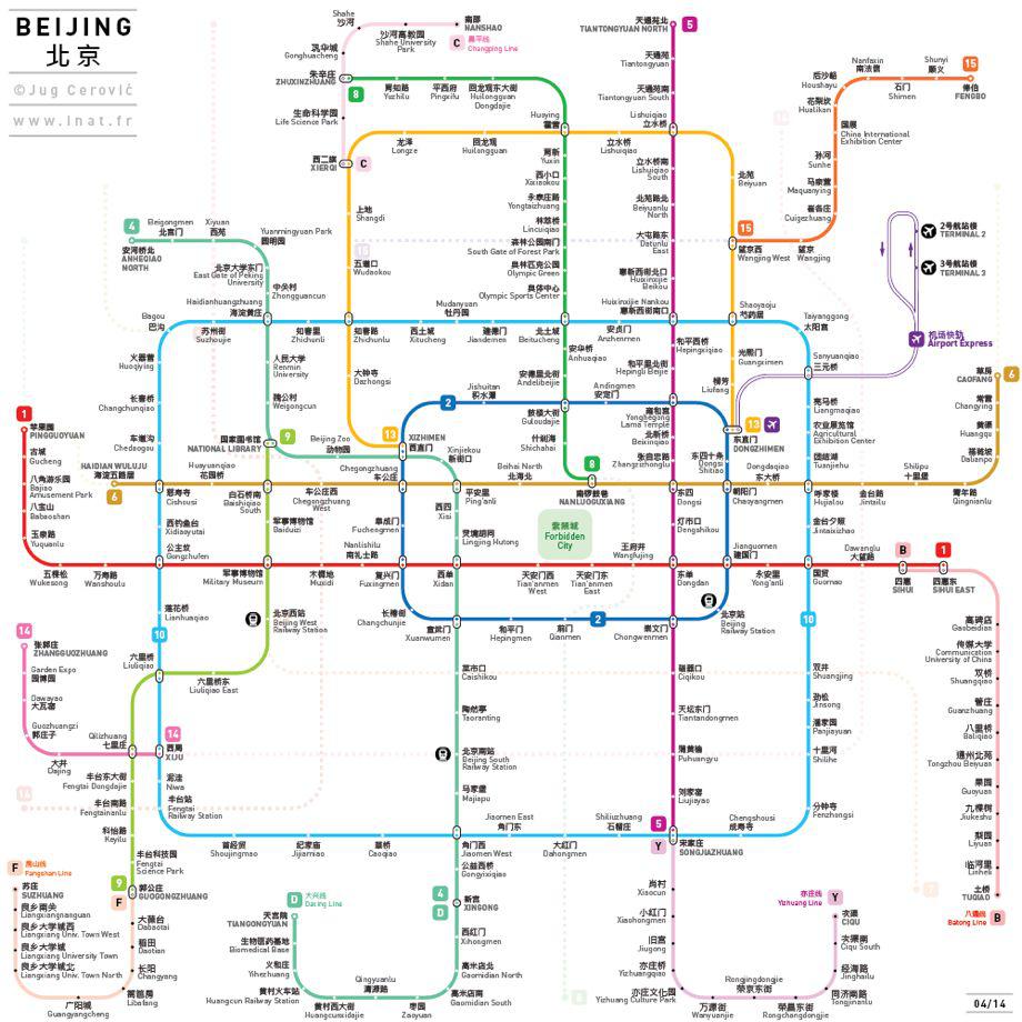
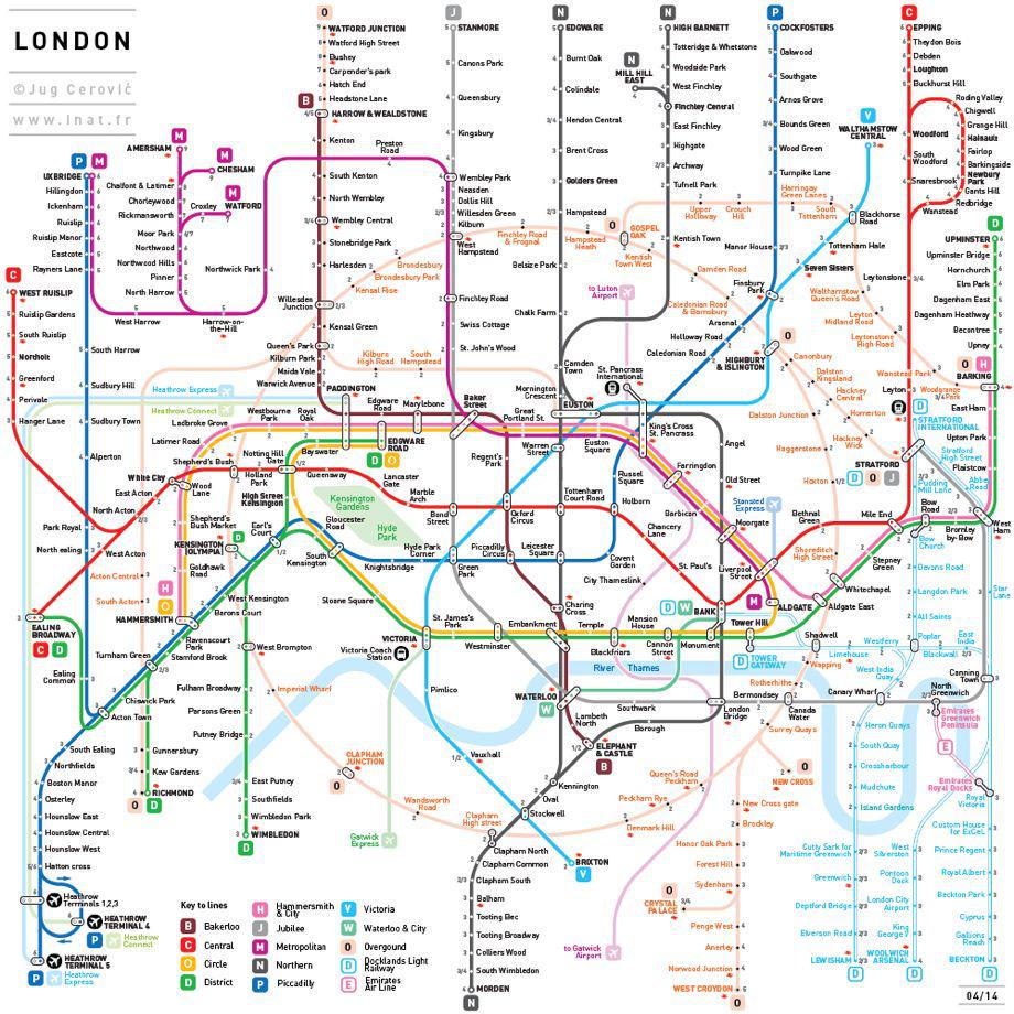
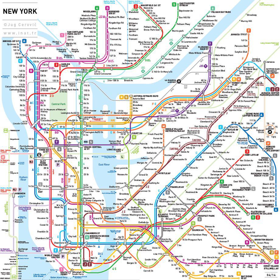
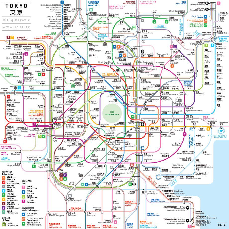
His INAT series of maps are meant to fit in your pocket and be easy to read and use: They enlarge dense city centers to make multiple lines and connecting stations more visible. A standard set of symbols is used for all maps and all lines are either vertical, horizontal, or at a 45 degree angle, most featuring no more than five bends.
Courtesy of Jug Cerovic
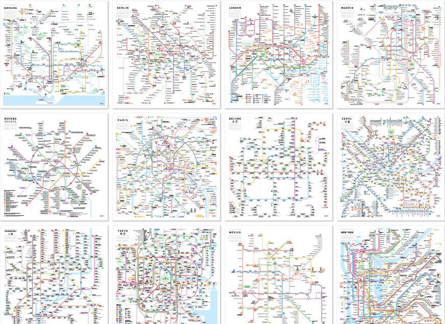
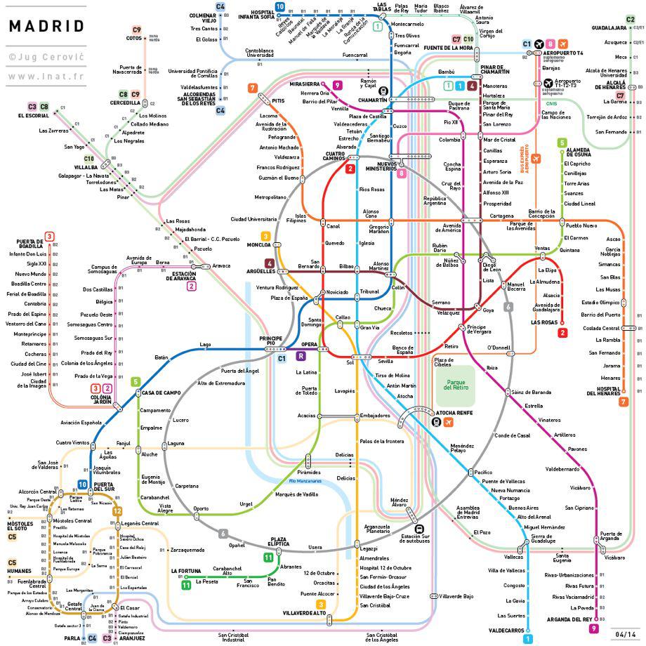
Cerovic uses shapes to indicate symbolic forms of various cities—circles for Moscow and Paris, rectangles for Beijing and Shanghai, a stadium shape for Berlin and Seoul, South Korea, parallelograms for London and regularly spaced straight parallel lines in gridded street pattern cities like New York and Mexico City.
Courtesy of Jug Cerovic
Cerovic told me in an email that he started by making maps for his native city of Belgrade, Serbia. “Since the city lacked a legible and useful map I designed a complete set of maps, detailed and schematic,” he said. “Then I tried to draw the Paris Métro map. Since I live in Paris and know the network pretty well, I wasn’t happy with the current official map and wanted one that suits me better. While working on Paris and then Madrid (for the same reasons) I developed a nomenclature, a standard that I then applied to other cities. And it worked! I ended up drawing 12 of the most complex Métro networks in the world.”
Courtesy of Jug Cerovic
Cerovic said he was unable to break through the bureaucratic red tape required to convince city governments to implement his maps, so he decided to complete an initial set of maps and publish them online. “Now that INAT maps are ready I would very much like the concerned cities to adopt them,” he said.
Courtesy Jug Cerovic
What does INAT stand for?
“Inat is a Serbian word quite difficult to translate, a mix of pride and stubbornness,” he said.
Courtesy of Jug Cerovic
Maps of a dozen cities are available for purchase in three sizes, and he hopes to develop a mobile phone app (for now, the maps are zoomable online). “They are meant to be useful first of all,” Cerovic said, adding that “since they are also visually pleasant you can also hang them on a wall or send them as a postcard.”
Courtesy of Jug Cerovic