When you think of the year’s best photos, you think of camera-slinging journalists and artists relying on their instincts and training to capture a moment of ineffable drama, beauty, or peace. The following images, however, were not taken by humans.
They’re snapshots sent down from DigitalGlobe’s WorldView-2 and WorldView-3 satellites, among the most powerful commercial satellites orbiting the planet. They’re capable of achieving resolutions so sharp that the U.S. government prohibits them from being released for public view. The examples here have been reduced to levels permissible under federal regulations.
Each December, DigitalGlobe holds a vote on Facebook to select the top satellite images of the year. You can see all 25 here. Below are some of our favorites, presented in chronological order. Where possible, for context, we’ve added links to related news stories that ran in Slate.
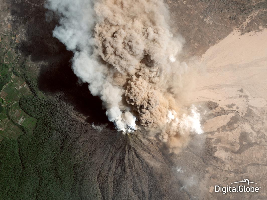
Photo by DigitalGlobe
The eruption of Mount Sinabung, in North Sumatra, Indonesia, was a thing of beauty, but also of death. More than a dozen people were killed as it spewed ash columns more than a mile high.
- “Like Volcanos Aren’t Scary Enough, Now They’re Spawning Twisters,” by Phil Plait
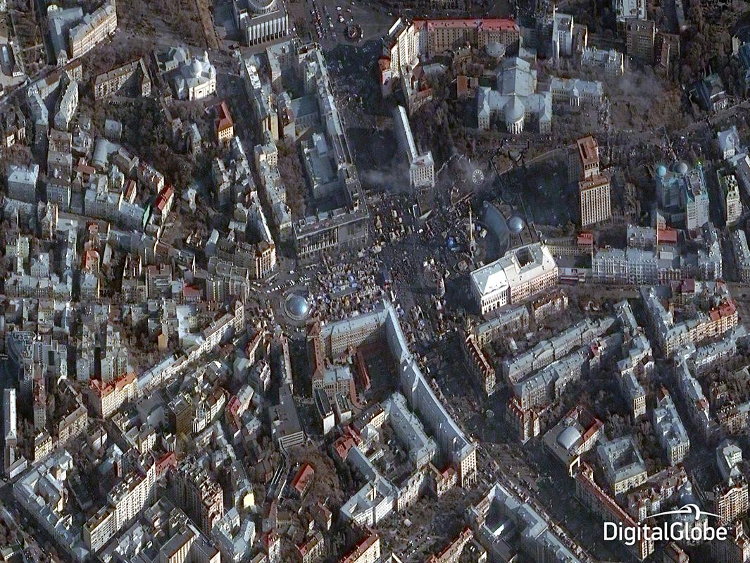
Photo by DigitalGlobe
Clashes between anti-government protesters and riot police turned Kiev’s Independence Square into a blazing battleground. From hundreds of miles above, the chaos takes on a more abstract quality, like a city hall protest in the computer game SimCity.
DigitalGlobe says government organizations can use its satellite imagery to track civil events by monitoring changes to the masses of people and tents, seeing where blockades have been placed, and other potential indicators of escalating violence.
- “Photos From the Anti-Government Protests in Ukraine,” by Juliana Jiménez Jaramillo and Joshua Keating
- “What You Need to Know Right Now About the Crisis in Ukraine: An FAQ,” by Joshua Keating
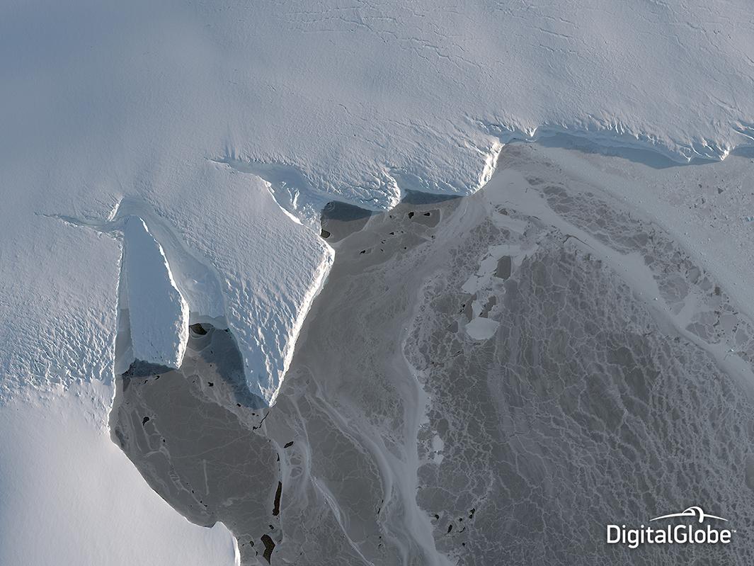
Photo by DigitalGlobe
Parts of Antarctica are losing ice at a rate of some 6.1 billion tons per year. Satellites can track climate change through the progress of receding glaciers, rising seas, and extreme weather events.
- “New Report Confirms Antarctica Is Melting Away as We Watch, Faster Every Year,” by Phil Plait
- “Antarctic Ice Melt Causes Small Shift in Gravity,” by Eric Holthaus
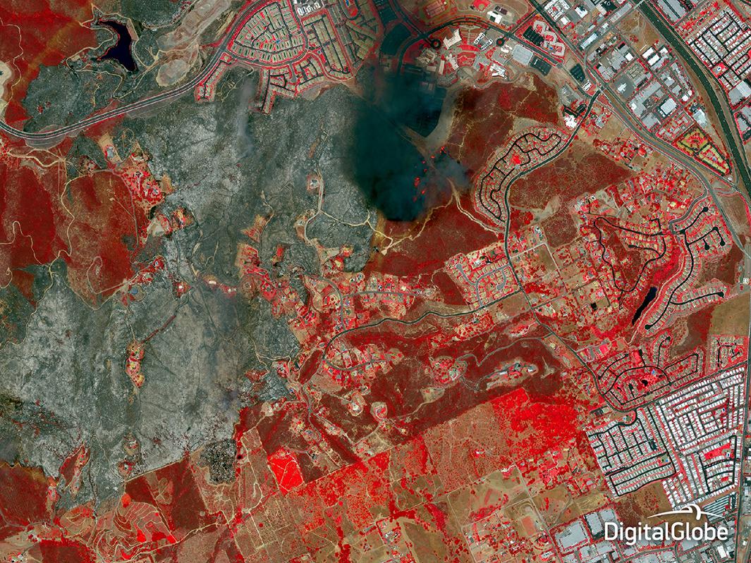
Photo by DigitalGlobe
An unseasonable heat wave and Santa Ana winds helped to fan spring wildfires that forced California State University–San Marcos to evacuate and cancel its commencement. First responders to wildfires use satellite imagery to locate hot spots, quantify burned vegetation, and determine damage to buildings.
- “California’s ‘Fire Season’ Is Basically Year-Round Now,” by Eric Holthaus
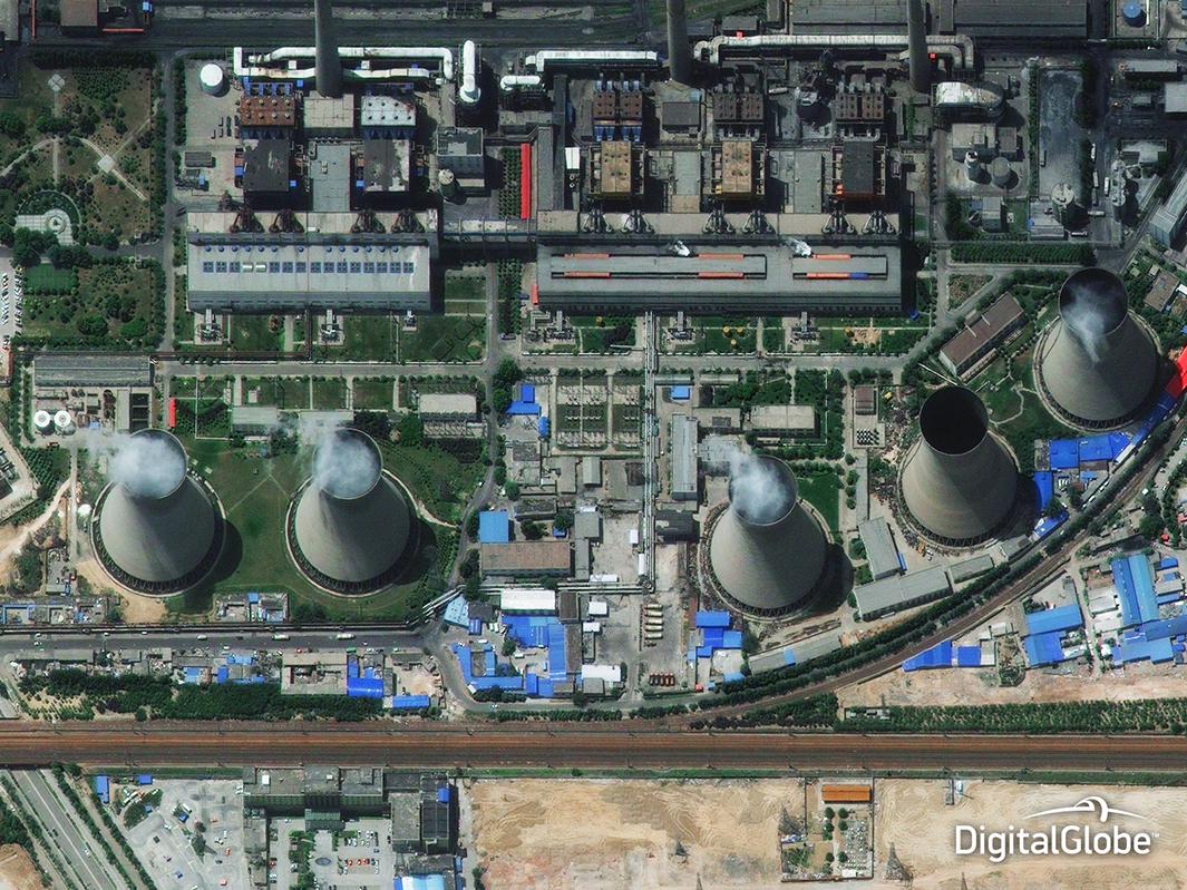
Photo by DigitalGlobe
China’s “airpocalypse,” in which smog from coal power plants and other pollutants choked major cities, helped spur action on climate change.
- “The Upside of the Airpocalypse,” by Joshua Keating
- “Why China Is More Likely to Keep Its Climate Promise Than We Are,” by Will Oremus
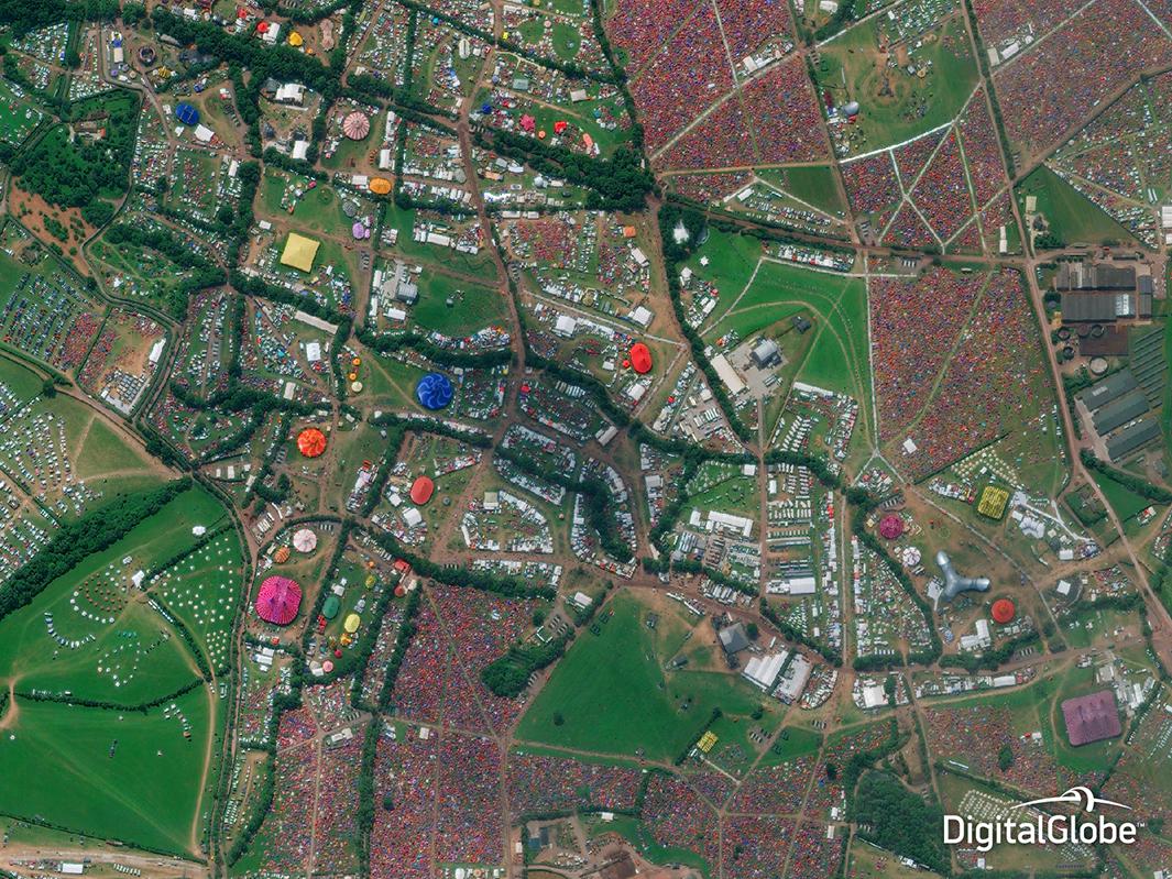
Photo by DigitalGlobe
Satellites can’t see the Arcade Fire or Metallica onstage—just the candy-colored tents and the monstrous crowds surrounding them.
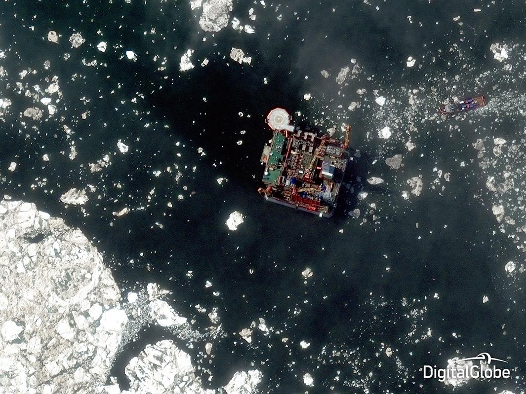
Photo by DigitalGlobe
The melting Arctic is opening new shipping lanes, and oil companies are rushing to capitalize.
- “Big Oil Used to Deny Climate Change. Now It’s Profiting From It,” by Will Oremus
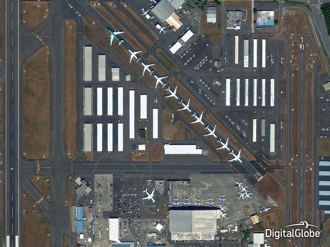
Photo by DigitalGlobe
Defense and intelligence agencies rely on images of airports for data and pattern analysis and “situational awareness,” DigitalGlobe says.
- “One Day’s Worth of North Atlantic Flights, Visualized,” by A.J. McCarthy
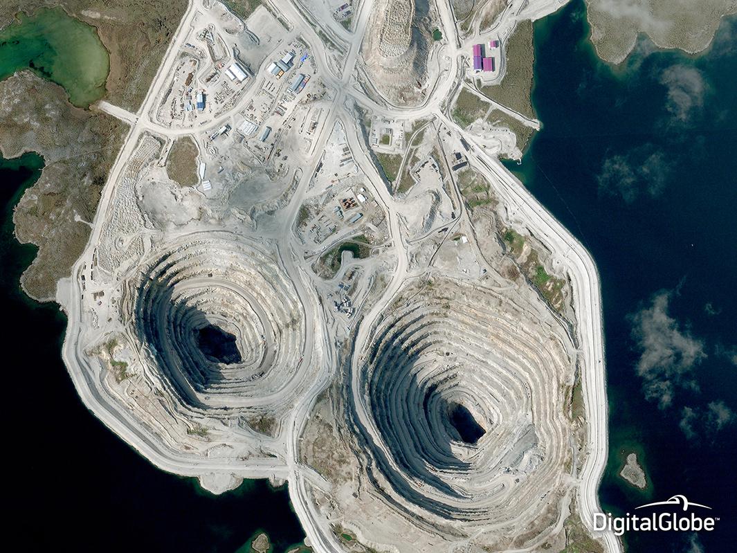
Photo by DigitalGlobe
The Diavik mine in the remote Northwest Territories produces diamonds for high-end jewelry in markets worldwide. In November, the British-Australian mining giant Rio Tinto announced plans for a $350 million expansion of its operations there.
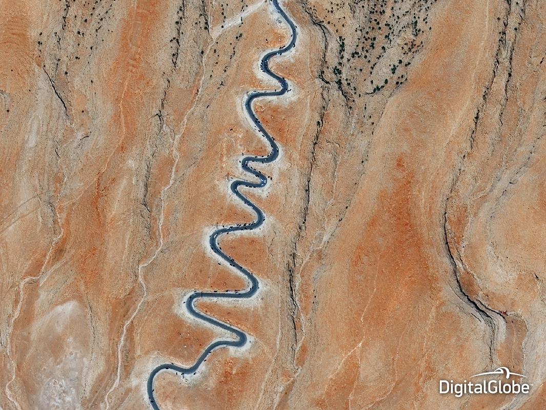
Photo by DigitalGlobe
Satellites captured an exodus from the Iraqi city of Sinjar, where Yazidi refugees traversed steep mountain switchbacks to escape a massacre by ISIS militants.
- “Things Are Getting Much Better on Mount Sinjar Thanks to U.S. Efforts, Pentagon Says,” by Joshua Keating
- “The ISIS Atrocities We Can’t Forget,” by William Saletan
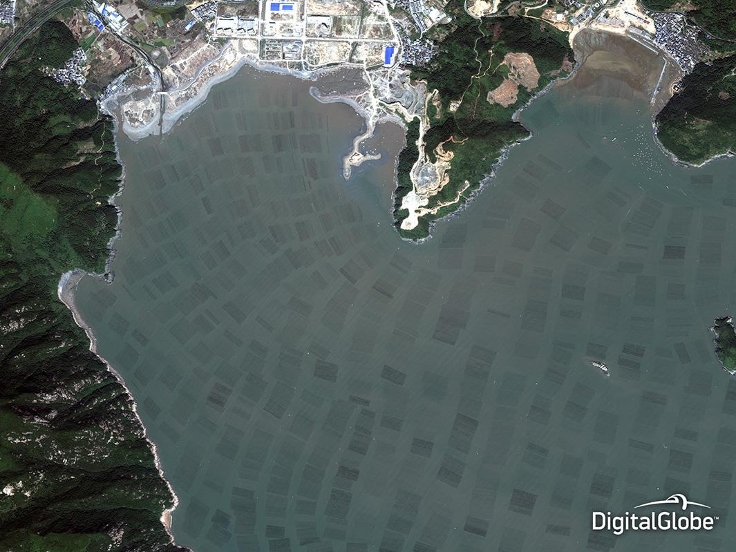
Photo by DigitalGlobe
Overfishing has depleted global stocks of fish, the world’s last major wild food source. As a result, aquaculture is booming, but the environmental impacts are mixed. Satellites can help monitor oxygen content, algae blooms, and other key conditions of the water surrounding large fish farms, as well as destruction of mangrove forests and other natural habitats.
- “There Aren’t Plenty of Fish in the Sea,” by Marian Swain
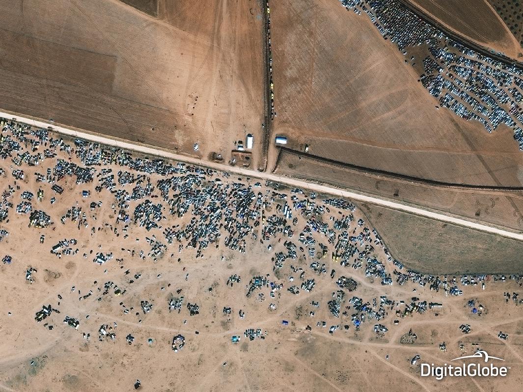
Photo by DigitalGlobe
A small city near the Turkish border became a flashpoint for the civil war in Syria, with ISIS militants battling Kurdish forces for months amid U.S. airstrikes. Tens of thousands of civilians who had fled to Kobani from elsewhere were forced to pick up stakes again as the fighting intensified, creating a humanitarian crisis of epic proportions.
- “Why Kobani Matters,” by Joshua Keating
- “U.N.: Syria Crisis Is ‘Biggest Humanitarian Emergency of Our Era,’ ” by Daniel Politi