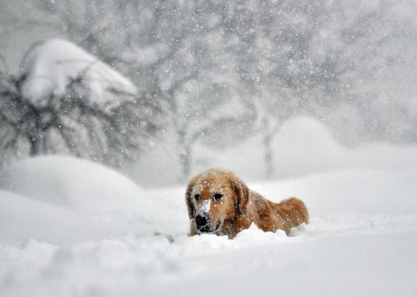
As Buffalo digs out from historic snows—maxing out at 88 inches, according to the National Weather Service—there have already been more than 30 major roof collapses in the area. The Buffalo News reports that a “Shovel Brigade Mob” of about 180 volunteers is planning to target homes in the hardest-hit areas this weekend.
A weekend warm-up also portends a potentially severe flood. That much snow converts to about 5 or 6 inches of water, and the coming temperature whiplash means it may all melt in about a day. The local National Weather Service office has already issued a flood watch, noting that “a southerly breeze and rising dew points will make for a more efficient melting of the snowpack.” Meteorologists from the National Weather Service still don’t really know for sure what they’re dealing with here, so they have reportedly been taking core samples of the snow to further refine the flood risk.
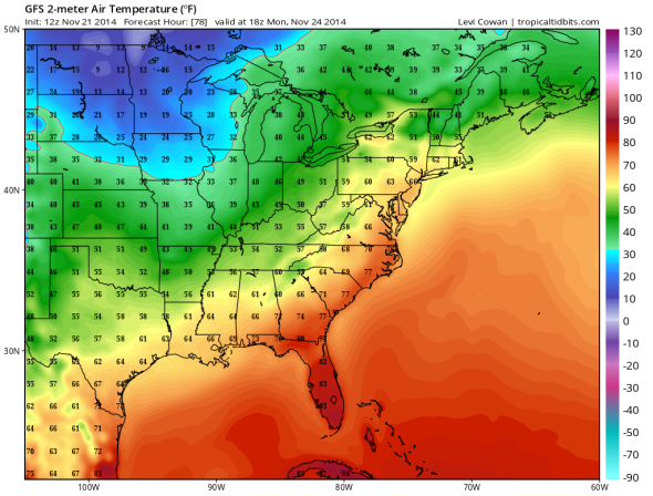
Image: GFS/Levi Cowan
The warm-up will come courtesy of an especially intense Midwestern cyclone that will feature low-level winds (about a mile off the ground) roaring at nearly 100 mph. That storm will drive warmer temperatures northward up the length of the East Coast and bring a temporary end to cold weather in Minneapolis. The last 12 consecutive days have been below freezing there, the longest stretch since 1880. On Thursday, the Upper Mississippi River was closed to shipping traffic near the Twin Cities due to a buildup of ice—the earliest winter closure since U.S. Army Corps of Engineers records began in 1969. The risk of blowing snow could lead to blizzard conditions on Monday in Minnesota, the National Weather Service noted in a technical discussion Friday.
After the storm passes, the East’s extreme-weather joyride will swerve into unknown territory.
The National Weather Service’s Weather Prediction Center, which handles medium-range (three-to-seven-day) outlooks, continues to note a “significant amount of forecast uncertainty” for the period following Tuesday. Many meteorologists have picked up on the latest model runs, which show the potential of a significant East Coast snowstorm on Wednesday—traditionally the busiest travel day of the year.
But that doesn’t mean you should freak out (yet) about a Thanksgiving-ruining nor’easter snowstorm. Sure, this map for Wednesday may look scary:
But look at what this same weather model (the newly upgraded GFS) was showing over its previous three runs:
That’s right, zilch.
The National Weather Service offices in New York City, Boston, and Washington, D.C., are all aware of the potential storm, but it’s still much, much too early to even think about changing travel plans yet.
Here’s NWS NYC: “As expected six days out, there are timing and intensity differences among the models.” They continue: “However, it should be noted several members of the 00z GEFS show a slower and stronger low closer to the coast. Will need to monitor future model trends as this will be occurring during the busiest travel day of the year. Uncertainties exist in how far west the precipitation shield will reach, and the extent of cold air in the low levels that will be available.”
Here’s NWS Boston: “Temps … suggest the possibility of wintery precip in the interior, but may be too warm along the coast. Still too uncertain here to make any calls, but worth watching given the potential travel implications.”
And NWS DC, which barely gives it a second thought: “At this time we also see differing model solutions in the handling of a developing low along the stalled front.”
You should barely give this storm a second thought, too. If the storm is still showing up in weather models on Monday, feel free to re-evaluate your respective freak-out levels.