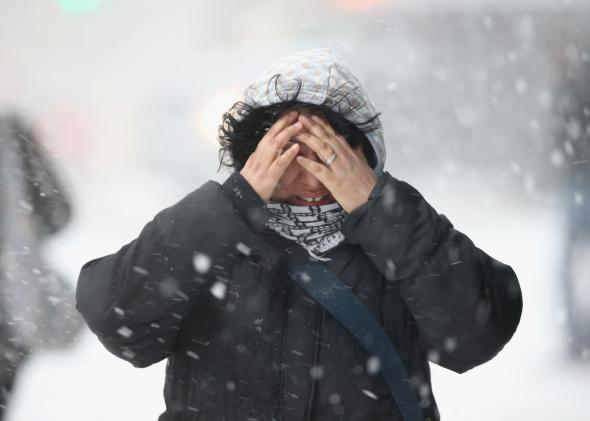
A Halloween winter storm is underway in the Midwest, and odds of measurable snow—while still low—are also creeping up for the Deep South and New England. Chicago’s first-ever White Halloween is already in the books.
America’s favorite weather buzzword is also back: One meteorologist has already dubbed the coming storm “Polar Vortex Charleston” to highlight the record-cold temperatures on the way to the South.
Let’s get one thing squared away right off the bat: For most places, this snow will be more novelty than incapacitating. At most, we’re talking an inch or two outside of the mountains in the South. That said, this was a real thing that happened not that long ago:
As we saw earlier this year, the South has had a tendency to descend into anarchy when winter rolls around. (The above photo was taken after just six inches or so had fallen—nothing like that is expected this time around.) Rightfully so, the National Weather Service is approaching this storm with an abundance of caution. Here’s what NWS forecasters in South Carolina had to say about the ‘wickedly dynamic’ system:
This low is in the neighborhood of five [standard deviations] below normal. So we do not see this type of system very often. Thus, we will be onguard in regard to the unexpected.
For stats nerds, that works out to about a once-in-50-years type event.
The Raleigh, North Carolina, office of the National Weather Service has also mentioned a few possible rumbles of thunder and lightning strikes, given the incredibly anomalous energy the storm system will be packing. One North Carolina meteorologist has traced the origins of the system back to the remnants of Hurricane Ana, which made a close brush with Hawaii earlier this month.
Although the anticipated snow totals may not impress when compared with early February, they’re off-the-charts for early November. There has never been measurable snow this early in the “winter” in this part of the Deep South—by nearly two weeks. (The earliest one inch or greater snowstorm on record in Charlotte was on Nov. 11—Charlotte records go back to 1878.)
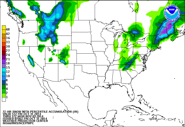
As the storm slides up the East Coast on Saturday and Sunday, it could draw additional energy from much warmer than normal coastal waters as it attempts to merge with the northern branch of the jet stream. In the process, tropical storm force winds will batter the North Carolina Outer Banks and coastal Massachusetts.
If you’re a snow lover in northern New England (especially Maine, where upwards of a foot is possible), this storm shouldn’t disappoint. Snow is off the table for New York City on Saturday night (though it may briefly be seen in the suburbs). It will be an especially chilly and blustery start to the city’s annual marathon on Sunday morning.
If you’re not quite ready to say goodbye to fall, don’t fret. The rest of the first half of November is looking warmer-than-average for most of the country. It’s way too early for snowmen, anyway.