In case you haven’t checked the calendar lately, it’s technically still summer. So how do you explain this?
Yep, you read that right: In 126 years of weather records, it’s never snowed this early in Rapid City, South Dakota. Some higher elevations just to the west of town got up to 8 inches, according to a National Weather Service report.
Tonight, Denver is expecting snow, too. If it falls, it’ll be the third earliest snowfall there on record.
The cold and snow were well forecast (I tweeted about it back on Monday), but that doesn’t take away the pain. If you live in the Northeast and think you can safely file this weather weirdness as something that’s just happening “Out West,” think again: Temperatures will dip into the 40s this weekend in the outskirts of New York and Boston, about 20 degrees colder than average for mid-September.
Last year, a similar early season Dakotas snowfall kicked off the epic winter (replete with polar vortices) that most of us would rather forget. So, are we in for something similar this year? Have I angered the Farmers’ Almanac gods?
To be completely honest, last winter’s crazy weather—cold and snowy in the East, warm in California—has never really gone away. Consider:
- Ice lingered until June this year on Lake Superior.
- In July, another round of the polar vortex broke all-time monthly cold records across the South.
- This summer was the hottest on record for Northern California as that state’s drought continued to expand. Since at least early 2013, a semi-permanent kink in the jet stream has left California behind, instead shunting rain clouds as far north as Alaska. (Amid this week’s September snowstorm, temperatures will be in the 90s along the West Coast, as far north as Portland.)
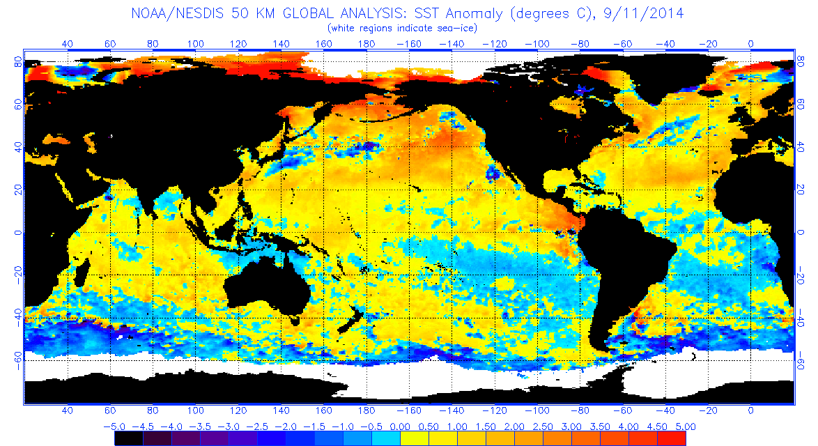
On Thursday, the National Climatic Data Center released its monthly U.S. climate report for August, whose graphics are virtually indistinguishable from any of the last dozen or so months: record-breaking heat out West and unseasonable chill in the East. Thanks to its eerie longevity, this weather pattern even has its own name: the Ridiculously Resilient Ridge.
The source of the RRR can be traced to a continent-sized blob of abnormally warm water just off the Pacific Coast. Since the ocean and atmosphere work in tandem to produce our daily weather, that means effects are being felt thousands of miles downstream.
Weather and climate scientists have released new research over the last few months showing a counterintuitive connection between persistent and extreme winter weather patterns and global warming. The melting Arctic has a lot to do with it, but scientists are still debating the details.
So, sticking to the science, what can we actually expect for the coming winter?
Using the Climate Prediction Center’s freshly updated long-range model suite, now’s as good a time as any to take a first guess. These models take into account semi-stable patterns of ocean temperatures to predict areas of relative drought and excess rain and warmth and frigidity over the next few months, and their historical accuracy is better than a random guess.
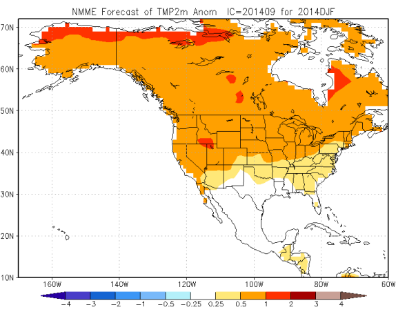
Image: CPC NMME
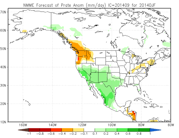
Image: CPC NMME
However, these maps don’t tell the whole story. Looking past December, the sub-models have a lot of variability, and some of them are looking a bit polar vortex-y. I’m running the risk of sounding Almanac-vague here, but I think you can bet on at least a few serious cold snaps during January and February. By and large (especially for the West Coast), though, it’ll thankfully be as warm if not warmer than last winter. Of course “warmer” is a relative term mid-January. Again, it’s a bit early to go on the record with a winter forecast, but I thought circumstances warranted a reality check. Seasonal weather forecasting is best thought of as a spread of probabilities, so, just think of the odds tilted slightly toward warmth this coming winter.
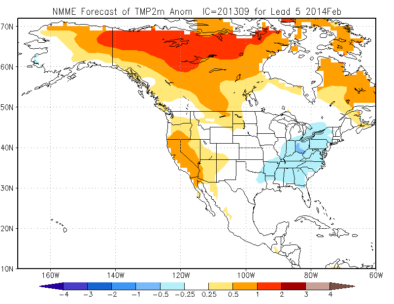
Last year at this time, these models were hinting at something pretty close to what actually happened, and that consistent Eastern cold signal isn’t showing up this year. So, despite this early season winter blast, I’m increasingly confident that a record-breaking winter like last year’s isn’t impending. When exactly the occasional (and inevitable) polar vortex comes along, though, is anyone’s guess.