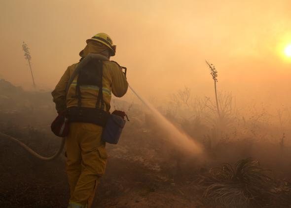
Wildfires are burning mostly out of control in San Diego County on Thursday as an unseasonably intense heat wave and strong, dry winds have prompted the governor to declare a state of emergency.
San Diego schools are closed today, while evacuation orders forced tens of thousands of people from their homes. Nearly 10,000 acres have already gone up in flames.
The worst fire, near San Marcos, was only 5 percent contained as of Thursday morning. The California State University–San Marcos campus was evacuated, and this week’s commencement was canceled, per a CNN report.
Offshore Santa Ana winds helped fan the flames, producing smoke plumes visible from space. Santa Ana winds funnel warm and dry air toward the coast when a strong high pressure moves over the deserts of inland California, reversing the typical west-to-east flow from the ocean that usually keeps Southern California so beautiful and temperate. During times of drought, Santa Ana winds bring humidities down to dangerously low levels, and they can blow up to hurricane force in the mountains, creating the perfect environment for explosive fire growth.
Relatedly, new data released Thursday showed 100 percent of the state of California is now in “severe,” “extreme,” or “exceptional” drought, the three most severe categories. Earlier this month, the governor’s Office of Emergency Services warned that this summer poses unprecedented wildfire risk.
Temperatures on Wednesday reached the triple digits, according to the National Weather Service. Some of Wednesday’s temperatures, like the 102-degree reading in Oxnard, were the hottest ever recorded in the month of May. Oxnard’s oppressive heat was strikingly out of season: It was more than a month earlier than the previous first 100+ degree day and just two degrees shy of the all-time record set on September 22, 1939. Records have been kept in Oxnard since 1923.
Some other daily records were shattered by more than 10 degrees. The hottest previous temperature for May 14 in Laguna Beach was 83, set in 1978. On Wednesday, it reached 99 degrees there. Laguna Beach records have been kept continuously since 1928.
The forecast for Thursday was even hotter, said the National Weather Service office in San Diego, though the Santa Ana winds will likely be calmer. As of 11:35 a.m. Pacific Time on Thursday, the Los Angeles airport had already set a new record high for the date: 97 degrees, breaking the old daily record of 94 set in 1956. According to the NWS, this heatwave surpasses the previous record set in San Diego in 1896—which came 10 days later in the month.
It didn’t take long for local officials to point out the connection to climate change, which scientists say is lengthening the fire season in California by several days per year. The Western wildfire season is now 78 days longer than it was in the mid-1980s. This year, due to worsening drought, the season effectively never stopped.
From NBC News:
San Diego Fire Chief Javier Mainar said the unusual weather pattern didn’t bode well for the rest of the season.
“It is pretty amazing to see these in May,” Mainar said. “We certainly have seen climate change and the impact of climate change. My understanding from Cal Fire is that we’ve seen twice the number of wildfire starts in the state of California as we typically see this time of year.”
The pictures from southern California were apocalyptic:
“Firenadoes,” like those shown above (and in video, here) are actually fairly common in intense wildfires. Here’s the science: Fires obviously generate a lot of heat, and heat rises. Heated air rises even faster when surrounded by relatively cooler air on the edges of major fires, and vortexes can form in particularly strong updrafts. If those vortexes contain flame, you’ve got yourself a firenado.
If the fire is large enough, it can also create its own weather. Pyrocumulus clouds, or billowing puffy white clouds created by the rising air above a wildfire, have even been known to trigger lightning storms, sparking fresh fires nearby.