If deforestation as a problem feels far away from your daily life, here’s some scale. Between 2000 and 2012, humans destroyed 500 million acres of forest, which is equivalent to 50 soccer fields a minute over those 13 years. That’s a lot a lot.
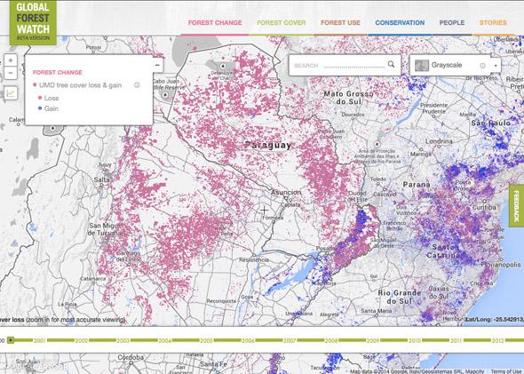
Successful projects, like one at the University of Maryland, used Google Earth and Google Maps to visualize the situation and look more closely at trends. And now Google has partnered with the World Resources Institute and 40 other organizations to offer a dedicated deforestation tool, Global Forest Watch.
The service does close to real-time updates and can surface different factors, like logging and mining, to offer a more detailed picture of what’s happening in a particular area. Global Forest Watch is meant to be easily accessible, so anyone can use it. One of the major goals of the service is to depict deforestation playing out in people’s communities, countries, or places of interest, so everyone can understand the scope and impact of the problem. If enough forest is destroyed, 50 soccer fields per minute will just become one Earth-sized soccer field.