An intensifying storm meteorologists are calling a “Texas Hooker” is pushing through the Midwest on Thursday, bringing a litany of extreme weather in its wake.
The storm system is already responsible for near-blizzard conditions in Minnesota and Iowa, strong winds across much of the country’s midsection, and at least two tornadoes in Illinois.
The Storm Prediction Center has upgraded the risk of severe weather across an area that includes parts of Mississippi, Tennessee, and Kentucky, and says the storm packs a ”widespread damaging wind risk” with a few more tornadoes possible by late Thursday. The SPC is also providing up to the minute tracking of severe weather caused by the storm.
As of early evening, tornado warnings—localized alerts that indicate a tornado has been spotted or is imminent—were becoming more prevalent between Memphis and Chicago.
Also happening via the same storm system—what else?—more winter. A Thursday evening headline from the National Weather Service in Minneapolis warned:
Conditions are deteriorating rapidly with heavy snow and a few thunderstorms. A few locations in northwest Wisconsin could see up to 16 inches by the time the snow ends on Friday.
Winds are expected to gust up to 60 miles per hour in Chicago on Thursday night as the storm pushes east, a result of the close juxtaposition of the storm’s intense low pressure center and the cold, dense, Arctic high pressure immediately behind it. The clash had already triggered a powerful line of thunderstorms that was expected to produce a sweeping swath of intense winds eventually stretching from New Orleans to New Jersey.
But as of Thursday evening, a radar loop showed the storm was still taking shape:
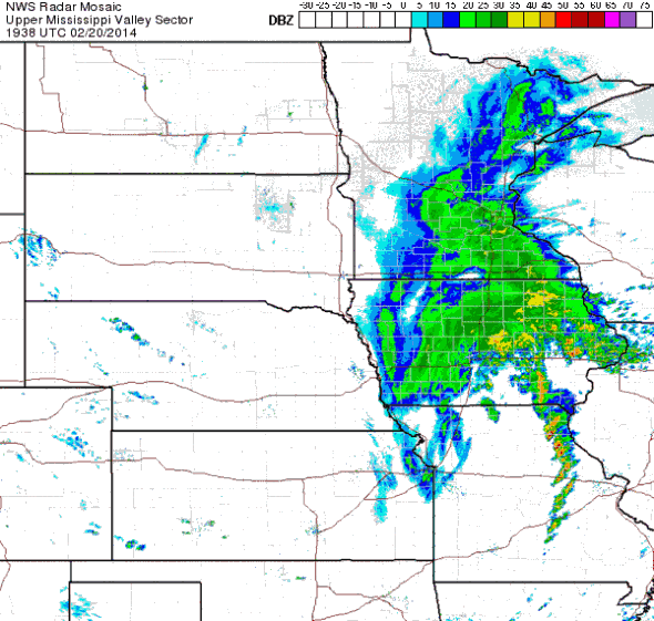
Image by the National Weather Service.
A remarkable temperature contrast had developed across the Midwest as of Thursday afternoon, with temperatures in the 70s and 80s from Missouri across the Southeast states, and near-blizzard conditions in some cases just one state away.
On the warm side of the storm, records toppled. Early on Thursday, Atlanta broke a 124-year-old record with an exceptionally warm morning low temperature of 59 degrees—a sharp contrast to the sub-freezing weather of the last several weeks. The National Weather Service confirmed that Charlotte, N.C.—just days ago buried under a blanket of snow and ice—recorded its warmest ever Feb. 20, with a high of 77 degrees Fahrenheit. New York City’s high temperature hit a balmy 51 degrees on Thursday, its warmest reading in nearly three weeks.
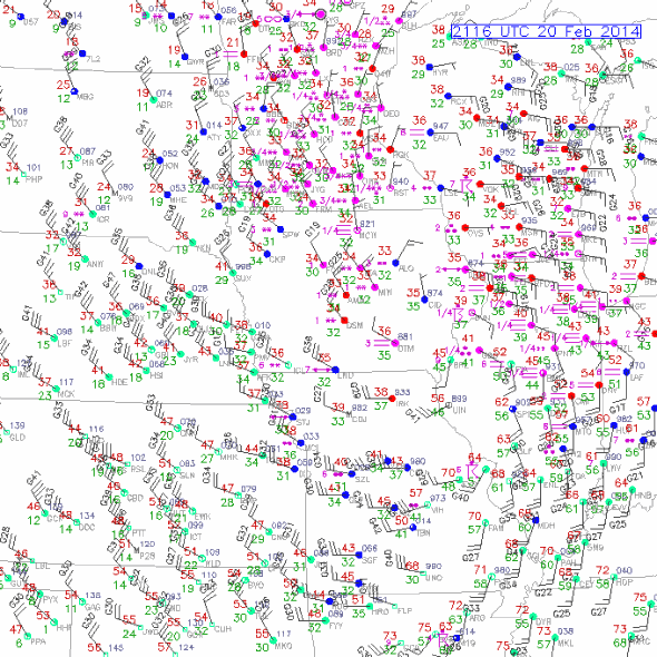
Image by the National Center for Atmospheric Research.
However, the warmth will not last.
Starting Friday, the storm’s intense cold could affect much of the Eastern part of the country via strong winds and a renewed blast of Arctic air.
As the storm retreats into Canada, the weather see-saw will tilt back toward Antarctica-lite for the East. The storm’s intense winds will usher in an extended period of extremely cold air over much of the eastern United States, culminating in a return of polar vortex-like frigidity by the middle of next week. The National Weather Service in Chicago says next week’s multiday cold air may be so extreme that morning lows could be “threatening records.”
As of Thursday, forecast models didn’t anticipate the coldest air extending as far into the Deep South as recent cold air outbreaks. Still, the forecast was enough to push commodity trading of natural gas prices to a five-year high on Wednesday, according to the Wall Street Journal. Prices Thursday were down slightly.
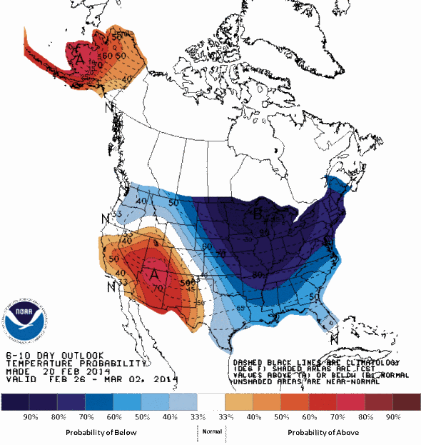
Image by NOAA Climate Prediction Center.
It’s enough to want to crawl under a rock and hibernate.